Perryton (Ohio)
| Perryton | ||
|---|---|---|
|
Location in Ohio
|
||
| Basic data | ||
| State : | United States | |
| State : | Ohio | |
| County : | Licking County | |
| Coordinates : | 40 ° 9 ′ N , 82 ° 12 ′ W | |
| Time zone : | Eastern ( UTC − 5 / −4 ) | |
| Height : | 245 m | |
| FIPS : | 39-62218 | |
| GNIS ID : | 1057919 | |
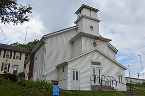
 Perryton United Methodist Church |
||
Perryton is an unincorporated community in Licking County in the US state of Ohio .
geography
Perryton lies on the western edge of the Brush Fork valley and extends north-south along Licking Valley Road.
history
On March 17, 1836, a post office was established in Perryton, which remained in operation until 1905. Perryton, like Perry Township, is named after the naval officer Oliver Hazard Perry .
supporting documents
- ^ Perryton ( English ) In: Geographic Names Information System . United States Geological Survey . July 12, 1979. Retrieved March 9, 2018.
- ↑ Perryton Post Office (historical) ( English ) In: Geographic Names Information System . United States Geological Survey . August 17, 1992. Retrieved March 19, 2018.
- ^ Ohio Licking County . Jim Forte Postal History. Retrieved March 19, 2018.
- ↑ Edwin MP Brister: Perry Township . In: Centennial history of the city of Newark and Licking County, Ohio . tape 1 . SJ Clarke Publishing Company, Chicago-Columbus 1909, p. 334-336 ( babel.hathitrust.org ).
