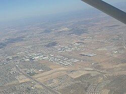
Phoenix Deer Valley Airport
| Phoenix Deer Valley Airport | |
|---|---|

|
|
| Characteristics | |
| ICAO code | KDVT |
| IATA code | DVT |
| Coordinates | |
| Height above MSL | 450 m (1476 ft ) |
| Transport links | |
| Distance from the city center | 17 miles north of Phoenix |
| Street | AZ 101 / I-17 |
| Basic data | |
| opening | 1960 |
| Flight movements |
370,034 (2016) |
| Runways | |
| 07R / 25L | 2498 m × 30 m asphalt |
| 07L / 25R | 1372 m × 23 m asphalt |
The Phoenix Deer Valley Airport english Phoenix Deer Valley Airport is an airport in Phoenix , Arizona in the United States .
Location and directions
The airport is located in the Dear Valley Village district, approximately 17 miles north of downtown Phoenix. The airport can be reached by car via Arizona State Route 101 or Interstate 17, among others .
Airlines and Destinations
The airport is not served by airlines in regular service ; it serves as an alternate and relief airport for Phoenix Airport .
Incidents
According to the Aviation Safety Network, there are no known aircraft accidents at the airport. In two crash tests, a Douglas DC-7 and a Lockheed L-1649 Starliner were destroyed for research purposes (April 1964 and September 1964).
Web links
Commons : Phoenix Deer Valley Airport - Collection of pictures, videos, and audio files
- Aerial photo and accident statistics. In: Aviation Safety Network. Retrieved August 20, 2010 .
- Airport data. In: The Airport Guide. Retrieved August 20, 2010 .
- The airport on Google. Retrieved August 20, 2010 .
Individual evidence
- ↑ Facts & Statistics. DeerValleyAirport.com, accessed June 19, 2017 .
- ↑ accident report DC-7 N68N , Aviation Safety Network (English), accessed on 17 January 2017th
- ^ Accident report L-1649 LV-GLI , Aviation Safety Network (English), accessed on January 17, 2017.