
Pik Wojennych Topografow
| Pik Wojennych Topografow | ||
|---|---|---|
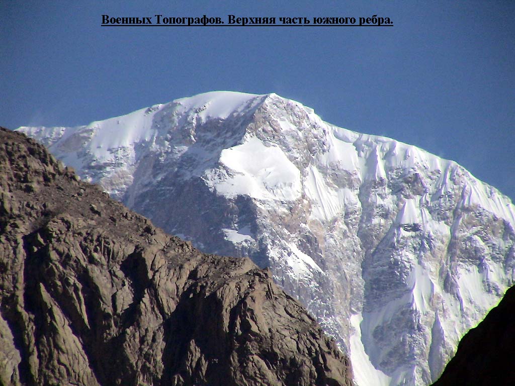
 View from the south: Pik Wojennych Topografow in the center of the picture in the foreground |
||
| height | 6873 m | |
| location | Circle wensu county in the administrative district of Aksu in Xinjiang ( China ) | |
| Mountains | Meridional chain ( Tian Shan ) | |
| Dominance | 10.16 km → Jengish Chokusu | |
| Notch height | 1385 m ↓ Tschong-Terek-Pass ( 5488 m ) | |
| Coordinates | 42 ° 3 '14 " N , 80 ° 14' 59" E | |
|
||
| First ascent | 1965, A. Wododochow | |

The Pik Wojennych Topografow is a mountain in the Chinese part of the Tian Shan not far from the border with Kyrgyzstan .
The 6873 m high mountain lies in the meridional chain . The Dschengisch Tschokusu ( Pik Pobeda ) rises 10 km further west. In between is the 5488 m high Tschong-Terek-Pass . The southern Engiltschek glacier has its upper end on the northern flank of the Pik Wojennych Topografow. The nutrient zone of the Eastern Tschong-Terek Glacier is located on the southern flank .
The name of the mountain comes from Russian and means "summit of the military topographers " ( Russian Пик Военных Топографов ).
Ascent history
The mountain was first climbed in 1965.
Web links
- Pik Voennizh Topografov, China / Kyrgyzstan on Peakbagger.com (English)
- Photos and information (Russian) at kantengri.kz
- Photo from the south at mountain.ru
Individual evidence
- ↑ Yevgeniy Gippenreiter, Vladimir Shataev: Six and Seventhousanders of the Tien Shan and the Pamirs (PDF (4.6 MB)) Alpine Journal, 1996, 122-130.