Meridional chain
| Meridional chain | |
|---|---|
|
Position of the meridional chain along the north-south border on the right edge of the picture |
|
|
View from the south: Pik Voennyh Topografov in the center of the picture in the foreground |
|
| Highest peak | Peak Voennyh Topografov ( 6873 m ) |
| location |
Kazakhstan , Kyrgyzstan , Xinjiang ( PR China ) |
| part of | Tian Shan |
| Coordinates | 42 ° 10 ′ N , 80 ° 16 ′ E |
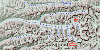
The meridional chain ( Meridianal´Nyj ; meridional = "related to the longitude") is a mountain range in the Tienschan in Central Asia .
The meridional chain runs in a north-south direction along the border between Kazakhstan and Kyrgyzstan in the west and the People's Republic of China in the east and in the extreme south. It stretches over a length of about 110 km and has 17 peaks over 6000 meters high. Except for the southern and northern foothills, it is consistently over 5000 meters high. The highest peak of the mountain range is the 6,873 m high Pik Voennyh Topografov located in the extreme southwest .
The upper ends of the two Engiltschek glaciers lie on the western slope of the meridional chain . On the opposite side of the slope to the east, the two glaciers flow Karagjul and Tugbeltschi . Coming from the west, the Sarydschaskette , the Tengritoo and the Kakschaaltoo meet the mountain range . A 25 km long mountain range branches off to the east with the Chulebos . Another mountain range branches off further south to the east to the Muzat .
Mountains (selection)
The following is a selection of the highest mountains sorted in north-south direction (in italics peaks with a lower notch height):
- Mramornaja Stena ( Plato Peak ), 6146 m
- P6261, 6261 m
- Spades 100 years of the Russian Geographical Society , 6180 m
- Pik Prschewalski , 6278 m
- Schater ( east summit ), 6637 m
- Schater ( west summit ), 6511 m
- Saladin peak , 6201 m
- Pik Sorge , 6107 m
- Peak Sneschnaja Skaska , 6000 m
- Pik Thorez , 6323 m
- Valichanov peak , 6060 m
- Peak Druzhba , 6800 m
- Pogrebetzki peak , 6527 m
- Nail of Spades , 6565 m
- Rapassow Peak ( West Summit ), 6800 m
- Rapassow Peak , 6814 m
- Pik Rapassow ( south summit ), 6747 m
- Peak Voennyh Topografov , 6873 m
Individual evidence
- ↑ Yevgeniy Gippenreiter, Vladimir Shataev: Six and Seventhousanders of the Tien Shan and the Pamirs (PDF 4.6 MB) Alpine Journal, 1996, 122-130.

