Saryjas chain
| Saryjas chain | ||
|---|---|---|
|
Merzbacher station with Sarydschas chain in the background |
||
| Highest peak | Bayankol ( 5841 m ) | |
| location |
Issyk Kul ( Kyrgyzstan ), Almaty ( Kazakhstan ) |
|
| part of | Tienschan | |
|
|
||
| Coordinates | 42 ° 16 ′ N , 80 ° 7 ′ E | |
| rock | Mica slate , limestone and granite | |
|
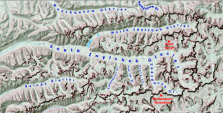
Location of the Sarydschas range north of the Northern Engiltschek Glacier (English North Inylchek Glacier) |
||
The Sarydschaskette ( Kyrgyz Сарыжаз кырка тоо ; Russian Сарыджаз Sarydschas ) is a mountain range in the far east of Kyrgyzstan and in the extreme south-east of Kazakhstan .
The Saryjas chain branches off to the west from the main ridge of the Tienschan . Of the 110 km long glaciated mountain range runs east-west between the valley of the Sarydschas in the north and the Engiltschek in the south. In the western section the maximum height is 4799 m . The summit Pik Semjonow , named after the Russian geographer Pyotr Petrovich Semjonow-Tjan-Schanski , has a height of 5816 m and lies on the state border between Kyrgyzstan in the west and Kazakhstan in the east. In the far east, the ridge runs completely within Kazakhstan for a length of about 15 km. At the junction with the meridional chain at the eastern end of the mountain range is the 6146 m high Mramornaja Stena (also Pik Plato ). The highest peak in the actual mountain range is the 5841 m high Bayankol in Kazakhstan . The Mushketow and Semyonov glaciers stretch on the northern slope . The latter belongs to the headwaters of the Saryjas. The Northern Engiltschek Glacier runs along the southern flank . The Saryjas chain consists mainly of metamorphic mica schist , limestone and granite .
Mountains (selection)
The following is a list of a number of peaks along the main ridge of the Saryjas chain, sorted from west to east:
![]() Map with all coordinates: OSM | WikiMap
Map with all coordinates: OSM | WikiMap
- Pik Proletarskoi Pechati ( 4871 m ) ( ⊙ ), Kyrgyzstan
- Piramida Peak ( 5332 m ) ( ⊙ ), Kyrgyzstan
- Pik Semjonow ( 5816 m ) ( ⊙ ), Kyrgyzstan / Kazakhstan
- Bayankol ( 5841 m ) ( ⊙ ), Kazakhstan
- Peak Kazakhstan ( 5761 m ) ( ⊙ ), Kazakhstan
Web links
cards
- Sheet 0/15 Khan Tengri - Tien Shan, Kyrgyzstan , Alpine Club Map 1: 100,000
Individual evidence
- ↑ a b c Article Sarydschaskette in the Great Soviet Encyclopedia (BSE) , 3rd edition 1969–1978 (Russian)
- ↑ peakbagger.com


