Pilot Lake
| Pilot Lake | ||
|---|---|---|
| Geographical location | Northwest Territories (Canada) | |
| Drain | Kenneth Creek → Tethul River → Taltson River | |
| Islands | 9 | |
| Location close to the shore | Fort Smith | |
| Data | ||
| Coordinates | 60 ° 17 ′ 1 ″ N , 111 ° 0 ′ 5 ″ W | |
|
|
||
| Altitude above sea level | 255 m | |
| surface | 43 km² | |
| Maximum depth | 90 m | |
|
particularities |
||
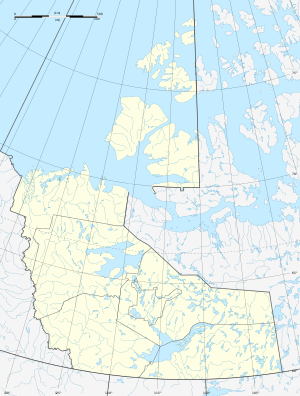
Pilot Lake is a lake in the Northwest Territories of Canada . The lake is located between Lake Athabasca and Great Slave Lake , 50 km east of Fort Smith and almost 30 km north of the Alberta border . The circular lake has a diameter of about 6 km. The lake is located in the catchment area of the Taltson River , a tributary of the Great Slave Lake .
The lake is used for fishing for the following fish: char , pike , coregonus and pike .
The lake lies in an impact crater , which has a diameter of 6 km and an age of about 445 ± 2 million years ( Upper Ordovician ).
Individual evidence
- ↑ Pilot Lake Cabins ( Memento of the original from October 10, 2007 in the Internet Archive ) Info: The archive link was inserted automatically and has not yet been checked. Please check the original and archive link according to the instructions and then remove this notice.
- ^ Earth Impact Database - Pilot
