Point Danger
| Point Danger | |||||
|---|---|---|---|---|---|
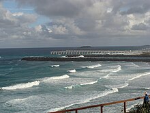
 Estuary of the Tweed River seen from Point Danger |
|||||
|
|||||
|
|||||
|
|||||
|
|||||
|
|
|||||
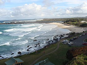
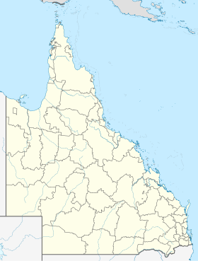
Point Danger is a headland at the southern end of the Gold Coast on the east coast of Australia . Point Danger is separated in the middle from the Australian states of Queensland and New South Wales . The northeastern Rainbow Bay with its snapper rocks popular with surfers in Queensland and the Tweed River Estuary in the southeast in New South Wales.
Point Danger has been the border between the two states since 1863. The Centaur Memorial is also located at Point Danger. The memorial commemorates the shooting down of the Australian hospital ship “Centaur” in 1943 by a Japanese submarine.
The “Walk of Remembrance” runs in a semicircle around the Point Danger Lookout and is a reminder of some lost Australian ships that were destroyed by Japanese and Germans in World War II .
history
The name "Point Danger" goes back to James Cook . This had to evade on May 16, 1770, when he met the reefs east of today's “Cook Island” and “Fingal Head” and consequently turned to the east and thus to the open sea. Cook Island and Fingal Head are located about 10 km south of today's Point Danger.
In his logbook , James Cook names the reefs that had been bypassed the day before as Point Danger. This place, ten kilometers south, is now called "Danger Reefs".
For many years there have been different opinions about the exact location of Point Danger. It is currently believed that Point Danger at its present-day location, i.e. in Tweed Heads, is not the place that Cook referred to as Point Danger in 1770. It is therefore correct that the original Point Danger is located on the southern Fingal Head, now known as "Danger Reefs".
Cook wrote in his log on May 17, 1770:
We now saw the breakers again they lay two leagues from a point under which is a small island, their situation may always be found by the peaked mountain before mentioned from them this mountain or hill, and on this account I have named Mount Warning it lies 7 or 8 Leagues inland the land is high and hilly about it, but it is conspicuous enough to be distinguished from everything else. The point off which these shoals lay I have named Point Danger.
lighthouse
Since 1971 there has been a 20 m high lighthouse at Point Danger, called Point Danger Light , with an attached James Cook memorial. Originally, the lighthouse was operated with lasers for test purposes. So the luminosity and range should be increased.
However, the project failed and the lighthouse was eventually converted to electric light. The lighthouse sends out a double flash of white light every ten seconds.
Web links
- Tweed heads . City's website. Retrieved January 30, 2011.
- Point Danger Lighthouse ( English ) In: Queensland Lighthouses . Lighthouses of Australia Inc. Retrieved May 6, 2019.
- Walk of Remembrance and Centaur Memorial . Big Volcano Tourism Marketing & Media. 2003. Retrieved July 23, 2008.
Individual evidence
- ↑ http://southseas.nla.gov.au/index_voyaging.html
- ^ "Cook's Point Danger" Geographical Names Board of NSW - ISBN 0-7313-8831-3
- ^ Minutes-Meeting of Tweed Shire Council Page 432-435 06/09/2000
- ↑ http://www.parliament.nsw.gov.au/prod/parlment/hansart.nsf/V3Key/LA20080409009
- ↑ Dr. Nigel Erskine's (Curator Exploration Australian National Maritime Museum) report dated March 8, 2007.
- ↑ The Point Danger Lighthouse ( English ) In: Queensland Lighthouses . Lighthouses of Australia Inc. August 6, 2003. Retrieved May 4, 2015.


