Pointe-à-raquette
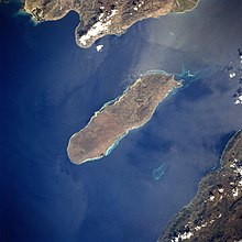
Pointe-à-Raquette ( Creole : Pwentarakèt) is a place and a municipality on the south side of the island Île de la Gonâve (formerly Île de la Gonaïve ) ( Haiti ). 24,518 inhabitants live in the municipal area on an area of 317.61 km². The place itself has 6301 inhabitants. (As of 2015)
The island represents an arrondissement (district) in the Haitian Ouest department and consists of the two municipalities Anse-à-Galets (capital of the arrondissement on the north side) and Pointe-à-Raquette. The postcodes on the Île de La Gonâve begin with 65.
The city is located about 50 kilometers west-northwest of the Haitian capital Port-au-Prince in the Gulf of Gonâve .
proof
- ^ Institut Haitien de Statistique et d'Informatique (ISHI): Population totale ... Estimes 2015, p. 30 , accessed on June 9, 2017
Coordinates: 18 ° 47 ′ N , 73 ° 4 ′ W

