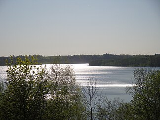
Western Suwałki Lake District
| Western Suwałki Lake District
Pojezierze Zachodniosuwalskie
|
||
|---|---|---|
|
Lake Rospuda Filipowska |
||
| location | Warmia-Masuria , Podlasie , Poland | |
|
|
||
| Coordinates | 54 ° 8 ′ N , 22 ° 37 ′ E | |
The Western Suwałki Lakeland (Pol. Pojezierze Zachodniosuwalskie ) is a Masoregion and lakes landscape in the provinces Warmia-Mazury and Podlasie in Poland .
location
The Western Suwałki Lake District is part of the Lithuanian Lake District ( Suwałki Lake District ). The Rominter Heide joins in the north, the Seesker Heights in the west, the Lycker Lake District in the south, the Augustów Plain in the southeast and the Eastern Suwałki Lake District in the northeast . The lake district is located in northeastern Poland, not far from the borders with Russia , Lithuania and Belarus .
geology
The Western Suwałki Lake District consists of a large number of lakes in a moraine landscape. Characteristic of this landscape are glacial channels between the hills, created by the erosive effect of the meltwater when the glaciers melted , which later took up the lakes.
Lakes
The largest lakes include Rospuda Filipowska and Garbaś .
Rivers
The most important river in the lake district is the Rospuda .
Moraines
The highest moraines in the area reach 240 meters above sea level.
colonization
The Eastern Suwałki Lake District is sparsely populated. There has not been a single city in the area since Bakałarzewo , Przerośl and Filipów lost their city status.
literature
- Andrzej Ber: Pojezierze Suwalsko-Augustowskie. Przewodnik Geologiczny. Warszawa: Wydawnictwa Geologiczne, 1981. ISBN 83-220-0131-2 .

