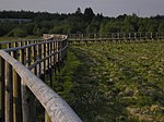
Polleur-Venn
The Polleur-Venn (French: La Fagne de la Poleûr ; Walloon Li fagne del Poleur , locally Lè Fagne dol Poleûr ), the location of a scientific station of the University of Liège since 1924 , combines the entire diversity of the High Fens on 54 hectares . The Polleur-Venn can be visited at any time of the year - even when the red flag is raised. This Venn area lies in the East Belgian communities of Weismes and Malmedy .
location
It is located directly on the N 68 ( Eupen - Malmedy) at the junction of the N 676 to Signal de Botrange . Access to the Polleur-Venn nature reserve is between the Mont Rigi restaurant and the Liège University station. There is an information office and a micro-museum in one of the university buildings. The circular route (approx. 90 min.) Mainly leads over wooden walkways. This manageable Venn area lies at around 660 m above sea level and is the source area for the Polleur brook, from Hockai onwards it takes the name Hoëgne .
history
The landscape was not created naturally. It is the work of human activity over centuries. 90% of the Venn areas were previously forested.
Until the Middle Ages there were mainly beech, oak and birch forests here. Until well into the 20th century, there was deforestation, peat extraction and agriculture and grazing. Until 1970 there was massive reforestation with the spruce. Nowadays, nature conservation, water and soil protection and the recreational factor come first.
Pollen analyzes of the peat layers made it possible to determine the vegetation of the last millennia down to a depth of approx. 6 m. Around 9400 BC BC the birch and the pine dominated the landscape. 8100 BC The oak spread. 6400 BC Alder, elm and linden were added. Around 3800 BC The beech tree expanded, and a great many hazel bushes and alders grew. The oak and linden tree population decreased, the birch tree settled on the peat. Heathland was created around 1250, the grass spread and the alder and hazel stocks declined.
use
The peat shaped the face of the landscape a long time. The families of the neighboring towns had a mining site certified by the community. Every year, 15,000 to 20,000 peat briquettes were burned per family.
The individual peat briquettes were dried in three phases. First rows were formed, then the briquettes came in small turrets of 5 and finally in piles.
Flora and fauna
In the 17th and 18th centuries, the beech forest was cut down for the production of charcoal. A vegetation of the open landscape has developed on the dry areas. This landscape is now shaped by the abundance of small shrubs. At the forest edges of Vennfläche have blueberries , cranberries and bog bilberries spread.
In the inner area of the Venn area, a peat bog is created thanks to special vegetation, which largely consists of peat moss and is adapted to the constantly humid conditions. This location is acidic and contains few bacteria and other decomposition organisms. The plants are only partially decomposed there and accumulate in layers that are up to 7 m high. On average, this layer increases by 1 mm every year. The widespread cotton grass is a plant typical of peat soils. Their white tufts are made up of silky hairs attached to the seeds and scattered by the wind as they ripen. To the left and right of the wooden walkways you will also find the seven-star , the symbol of the nature reserves in the High Fens.
The water from the peat areas is acidic and contains few minerals. This severely restricts the development of life in the water of the nearby streams. The fish and flowering plants are missing there. There is little algae and moss, some small invertebrates can exist in them.
The water from the peat bogs contains elements with a foaming effect (vegetable saponins , unsaturated fatty acids ). A whitish foam that is greasy to the touch forms in the eddies of the streams.


