Pomeranian Switzerland
| Pomeranian Switzerland
Szwajcaria Pomorska
|
||
|---|---|---|
| location | West Pomerania , Poland | |
|
|
||
| Coordinates | 53 ° 35 ' N , 16 ° 2' E | |

The Pomeranian Switzerland (Polish: Szwajcaria Pomorska ) is a hilly landscape in Pomerania in the Polish West Pomeranian Voivodeship . It is a part of the West Pomeranian Lake District on the Baltic ridge . The term Pomeranian Switzerland has not become established in Polish and is only rarely used. In Poland, the Dramburger Lake District (Polish: Pojezierze Drawskie ) is regularly mentioned when referring to Pomeranian Switzerland. The area around Połczyn-Zdrój (Bad Polzin), however, is called Polziner Schweiz (Polish: Szwajcaria Połczyńska ) in Polish .
Geographical location
Pomeranian Switzerland is about 30 km west of Szczecinek and stretches from Połczyn-Zdrój (Bad Polzin) in the north to Drawsko Pomorskie (Dramburg) in the southwest and Złocieniec (Falkenburg) and Czaplinek (Tempelburg) on Jezioro Drawsko (Dratzigsee) in the south . The Polzin – Tempelburg section of highway 163 runs through the region. The hilly landscape of Pomeranian Switzerland rises to around 250 meters above sea level.
Landscape image
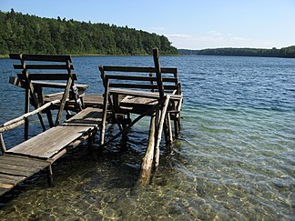
The hilly landscape, which is about 150 meters above sea level, is characterized by numerous lakes, streams and wooded gorges and by idyllic old small towns with partly medieval structures, such as Tempelburg or Falkenburg, located on the lake banks and slopes. On some southern slopes, so north of the Gr. Kammerer See , there are vineyards. The valley of Fünfsee , which begins about 3 km south of Polzin and extends from there in a south-easterly direction , a gorge only 100 meters wide in places, which is bordered by steep slopes up to 70 meters high and in which there are five, is particularly picturesque Line up small lakes that form the headwaters of the Drawa . From north to south these are: the Upper Lake (Jezioro Krzywe), the Round Lake (Krąg), the Long Lake (Jezioro Długie), the Deep Lake (Jezioro Głębokie, 45 meters deep) and the Small Lake (Jezioro Małe). In the center of the region lies the 18.7 square kilometer bay-rich Dratzigsee, which was 83 meters deep and was the deepest lake in northern Germany until the end of the Second World War.
literature
- Wilhelm Halbfass : Contributions to the knowledge of the Pomeranian lakes , with 6 cards. Petermanns Geographische Mitteilungen, supplement 136, Gotha 1901, online.
- Rügen and the Pomeranian coast with its hinterland. 2nd Edition. Bibliographisches Institut, Leipzig 1924, pp. 200–206 ( German Baltic Sea Coast 2 = Meyer's travel books ).
- Carl Schröder: Guide through Pomeranian Switzerland. Emil Hartmann, Greifswald 1930.
- Pomeranian Switzerland. Schivelbein, Bad Polzin, Tempelburg, Falkenburg, Kallies, Neustettin, Pollnow, Stolp. Universum-Verlagsgesellschaft, Berlin 1933 ( Germany picture booklet 192).
Web links
See also
Individual evidence
- ↑ Street map P004: Southern Pomerania - Netzebruch , Höfer Verlag, Dietzenbach, ISBN 978-3-931103-17-0 .

