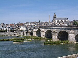
Pont Jacques Gabriel
Coordinates: 47 ° 35 ′ 7 ″ N , 1 ° 20 ′ 14 ″ E
| Pont Jacques Gabriel | ||
|---|---|---|
| use | Road bridge | |
| Crossing of | Loire | |
| place | Blois | |
| construction | Stone arch bridge | |
| overall length | 283 m | |
| width | 15 m | |
| Number of openings | 11 | |
| start of building | 1716 | |
| opening | 1724 | |
| planner | Jacques Gabriel | |
| location | ||
|
|
||
The Pont Jacques Gabriel is a bridge over the Loire in Blois , Loir-et-Cher department , France . It connects the city center with Avenue Wilson on the south bank of the Loire and is still one of the most important crossings over the Loire in Blois.
description
The Pont Jacques Gabriel is a 283 m long and 15 m wide stone arch bridge with 11 round arches with different spans. The middle arch has the largest span at 26.30 m. The pillars have different thicknesses between 4.85 m and 6.82 m. The road surface has its highest point on the middle arch, which is crowned by a 14.6 m high pyramid, and slopes downward on both banks with a clear gradient. The road is divided into three lanes and one cycle path each. After the bike paths have been created, there is only one sidewalk on one side. The bridge is framed by massive stone parapets.
history
After the medieval bridge was destroyed in 1716, work on the current bridge began under the direction of the architect Jacques Gabriel . It was completed in 1724. The bridge is the last of the Loire bridges with a carriageway that rises towards the center. To facilitate traffic, the aim was to achieve the flat decks possible.
In the course of history, several bridge arches were destroyed and then rebuilt.
Web links
- Pont Jacques Gabriel. In: Structurae
- Le pont Jacques Gabriel à Blois on Petit Patrimoine


