Pont Julien
Coordinates: 43 ° 51 ′ 45 ″ N , 5 ° 18 ′ 24 ″ E
| Pont Julien | ||
|---|---|---|
| View from the west | ||
| Convicted | Via Domitia | |
| Crossing of | Calavon | |
| place | near Bonnieux ( France ) | |
| construction | Arch bridge with vaulted vaults | |
| overall length | 117.70 m | |
| width | 5.90 m | |
| Number of openings | 3 | |
| Clear width | Max. 16 m | |
| Clear height | 9 m | |
| completion | 3 v. Chr. | |
| location | ||
|
|
||
The Pont Julien is a Roman stone arch bridge from 3 BC. In Provence .
Location and surroundings
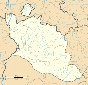
The Pont Julien spans the Calavon about five kilometers north of the town of Bonnieux in the French department of Vaucluse . The bridge is part of the Via Domitia , a Roman road that connected Narbonne ( Colonia Narbo Martius ) with Turin ( Augusta Taurinorum ). Its name is derived from its proximity to the city of Apt ( Colonia Apta Julia ). It replaced an older bridge, the traces of which can still be traced on individual pillars.
Construction and data
The Pont Julien is 117.70 m long and 5.90 m wide, the drivable area is 4.20 m wide. The height of the bridge rising towards the middle reaches 9 m at the apex. It consists of three arches, the middle one being higher than the two flanking it. The middle arch has a span of 16 m and the two flanking arches each have a span of 10.20 m. The middle bridge piers are also broken up by large arched openings in order to offer less contact surface for possible floods . The limestone from which the bridge was built comes from the quarries of the nearby Luberon .
History of the structure
The Roman bridge was part of Departementstrasse 108 until spring 2005 and was used accordingly; At that time a parallel bridge was put into operation about 100 m away as part of a short bypass road. Thanks to its 2000 years of use, the Pont Julien is one of the best preserved Roman bridges in France.
literature
- Philippe Murati: Ponts de Provence , Nice 1994, pp. 19-20
See also
Web links
- Pont Julien in the Base Mérimée of the French Ministry of Culture (French)
- Pont Julien. In: Structurae
- Pont Julien in bridge web

