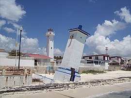
Puerto Morelos
| Puerto Morelos | ||
|---|---|---|
|
Coordinates: 20 ° 51 ′ N , 86 ° 53 ′ W Puerto Morelos on the map of Quintana Roo
|
||
| Basic data | ||
| Country | Mexico | |
| State | Quintana Roo | |
| Municipio | Puerto Morelos | |
| Residents | 9188 (2010) | |
| Detailed data | ||
| height | 4 m | |
| Puerto Morelos sea port | ||
Puerto Morelos is both a city and a seaport in Quintana Roo , Mexico's easternmost state on the Yucatán Peninsula . The city is the administrative seat of the municipality of Puerto Morelos, which was newly created in 2015, in the northeast of Quintana Roos, about 36 km south of the spa town of Cancun . The marine terminal in Puerto Morelos is equipped with containers and is the largest and most important seaport in the state of Quintana Roo.
Resident of Puerto Morelos
| year | population |
|---|---|
| 1980 | 672 |
| 1990 | 740 |
| 1995 | 829 |
| 2000 | 892 |
| 2005 | 1,097 |
| 2010 | 9,188 |
Puerto Morelos has grown rapidly with the development of tourism and the 2010 census showed 9,188 people in the population. Between 2005 and 2011 several places were incorporated into Puerto Morelos.
Web links
Commons : Puerto Morelos - Collection of Images, Videos and Audio Files

