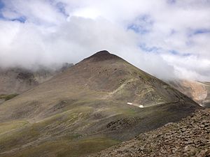
Puig de Fontnegra
| Puig de Fontnegra | ||
|---|---|---|
|
Puig de Fontnegra (2728 m) |
||
| height | 2728 msnm | |
| location | Catalonia ( Spain ) | |
| Mountains | Pyrenees | |
| Coordinates | 42 ° 24 '12 " N , 2 ° 10' 55" E | |
|
|
||
The Puig de Fontnegra (Spanish: Pic de Fontnegra) is a mountain in the northern Catalan Eastern Pyrenees ( Spain ).
Accesses
Three moderately difficult, unmarked but easily recognizable hiking trails lead to the summit, which offers a beautiful view in all directions.
Easiest access: Sanctuary in the Vall de Núria (1,967 m) - Alberg Pic d'Àliga (Youth hostel in the Vall de Núria, 2122 m, up to here also by cable car) - Pic d'Àliga (2422 m) - Puig de Fontnegra (- further to the Coll de Noucreus or Torreneules ).
In winter, the summit can be climbed from Vall de Núria on touring skis and snowshoes .
literature
- Roger Büdeler: Pyrenees 3 - Spanish Eastern Pyrenees: Val d'Aran to Núria . Bergverlag Rother, Munich 2004, ISBN 3-7633-4309-1 .
- F. Salvador, R. Ma. Asencio: Vall de Núria - Plànol d'excursions . Ferrocarrils de la Generalitat de Catalunya, Ripoll 1991 edition 2001.
- Puigmal, Vall de Núria, Ulldeter - Mapa i guia excursionista i turística; Editorial Alpina, SL: ISBN 84-8090-196-9 ; Societat Gestora d'Informació Territorial, GEOESTEL, SA: ISBN 84-9578-846-2 .

