
Pyhtää
| coat of arms | map |
|---|---|

|

|
| Basic data | |
| State : |
|
| Landscape : | Kymenlaakso |
| Administrative community : | Kotka-Hamina |
| Geographical location | 60 ° 29 ′ N , 26 ° 32 ′ E |
| Surface: | 780.97 km² |
| of which land area: | 324.73 km² |
| of which inland waterways: | 11.66 km² |
| of which sea area: | 444.58 km² |
| Residents : | 5,187 (Dec 31, 2018) |
| Population density : | 16 people / km² |
| Municipality number : | 624 |
| Language (s) : | Finnish , Swedish |
| Website : | pyhtaa.fi |
Pyhtää [ ˈpyhtæː ] ( Swedish : Pyttis ) is a municipality on the south coast of Finland with 5187 inhabitants (as of December 31, 2018). It is located in the Kymenlaakso landscape around 25 kilometers west of Kotka and 118 kilometers east of the capital Helsinki . 11 percent of the population are Finland-Swedes , so Pyhtää is the only officially bilingual community in Kymenlaakso.
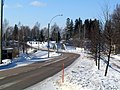
State road 7 runs through Pyhtää, the course of which is followed by the European route E18 to Saint Petersburg and the King's Road , the old route of the Swedish kings from Turku to Vyborg . Today the Königsstrasse is a tourist route. Sights in Pyhtää include the medieval stone church from 1460 and the Savukoski (Rökhusforsen) bridge built in 1928. The 17 square kilometer Valkmusa National Park with its marshland, which is unique in southern Finland, is mostly located in the municipality of Pyhtää. The archipelago off the coast of Pyhtää is part of the Eastern Gulf of Finland National Park .
Localities
To the municipality belong the places Heinlahti (Heinlax), Hinkaböle, Hirvikoski (formerly Österhirvikoski), Itäkirkonkylä (Österkyrkoby), Itämyllykylä (Österkvarnby), Kiviniemi (Stensnäs), formerly Lillkuppis (Vänsiköby), Länsiköirkon (Klåsyerkyls), Lyräkylsirkon , formerly Västerkuppis), Länsimyllykylä (Västerkvarnby), Malmi (Malm), Munapirtti (Mogenpört), Pirtnuora (Pörtnor), Siltakylä (Broby, formerly Storkuppis), Suur-Ahvenkoski (Storabborrfors) and Purola.
photos

The medieval stone church of Pyhtää

Swamp spring in Valkmusa National Park
Bridge in the village of Siltakylä


Individual evidence
- ↑ Maanmittauslaitos (Finnish land surveying office): Suomen pinta-alat kunnittain January 1, 2010 (PDF; 199 kB)
- ↑ Statistical Office Finland: Table 11ra - Key figures on population by region, 1990-2018