Hamina
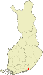
| coat of arms | map |
|---|---|

|

|
| Basic data | |
| State : |
|
| Landscape : | Kymenlaakso |
| Administrative community : | Kotka-Hamina |
| Geographical location | 60 ° 34 ′ N , 27 ° 11 ′ E |
| Surface: | 1,155.17 km² |
| of which land area: | 609.50 km² |
| of which inland waterways: | 23.18 km² |
| of which sea area: | 522.49 km² |
| Residents : | 20,286 (Dec. 31, 2018) |
| Population density : | 33.3 inhabitants / km² |
| Municipality number : | 075 |
| Language (s) : | Finnish |
| Website : | hamina.fi |
Hamina [ ˈhɑminɑ ] ( Swedish Fredrikshamn [ freːdriksˈhamn ]) is a south-eastern Finnish port city on the Gulf of Finland , 150 km east of Helsinki .
history
In 1653 the renaissance town Vehkalahden Uusikaupunki ( Veckelax Nystad ) was built on the site of today's Hamina on the old Königsstraße . The fan-shaped street network was based on an octagonal square on which the town hall stands today. When Vyborg fell to Russia in the Great Northern War in 1721 , the Swedish protective power began to convert Vehkalahti into a fortress. To a Swedish fortress to be worthy of it was built by King I. Fredrik unceremoniously in Frederikshamn renamed. From then on, the farmers and fishermen in the region shortened the name to Hamina, which seemed easier to them. In 1742, however, Sweden had to cede eastern territories conquered by Russia with the renamed place to Russia . Loviisa became the new border town . In 1809 the Treaty of Hamina (also: Treaty of Fredrikshamn) was signed in Hamina . The eastern regions, including Hamina, were reunited with the rest of Finland.
Attractions
Hamina is one of the most beautiful cities in southern Finland. The town hall, originally from 1797, is located in the city center. After a fire in 1840, Carl Ludwig Engel renovated it in a neoclassical style and added a tower.
The Marienkirche is a stone church from the 15th century. During renovations in 1820 it was given a neoclassical facade, also designed by Carl Ludwig Engel. The church is the oldest building in the Kymenlaakso region . A church museum is attached to the church.
The orthodox church "Peter and Paul" has a distinctive dome and has been built after a round temple. The church was originally built between 1832 and 1837 as a garrison church for Russian soldiers .
The Johanniskirche opposite the town hall was designed by Carl Ludwig Engel and was built in 1843. The church is shaped like a Greek temple. Before the church was built, this was where the fortress commanders apartment stood. It is here that the Treaty of Hamina was signed in 1809. A memorial stone next to the church reminds of this.
Hamina is the location of the Finnish Reserve Officers School . It is housed in a magnificent building from 1898.
The Central Bastion, or Hamina Bastion, was built from 1801 to 1811. The 58 rooms were laid out as bomb-proof storage facilities. Today the bastion is used as a venue and for tourist purposes. The military music festival "Hamina Tattoo" takes place here every two years. In addition to the central bastion, there are the Hamina bastions, the Savonlinna bastions, the Hämeenlinna bastions and the Lappeenranta bastions.
In 2009, Google Inc. bought a former paper mill and built a data center in it.
traffic
Hamina is on the E 18 . The port specializes in wood products and trade with Russia.
Demographics
Development of the population (as of December 31) :
- 1990 - 22,589
- 2000 - 21,847
- 2002 - 21,720
- 2004 - 21,887
sons and daughters of the town
- Christian von Steven (1781–1863), Russian botanist and entomologist
- Harry Wahl (1869–1940), sailor, silver medalist at the 1912 Olympic Games
- Magnus Enckell (1870–1925), painter
- Hugo Simberg (1873–1917), painter
- Carl-Johan Sundström (1902–1959), politician and ambassador
- Simo Häyhä (1905–2002), sniper in World War II
- Veikko Lommi (1917–1989), rower
- Oiva Lommi (1922-2000), rower
- Marjatta Kajosmaa (* 1938), cross-country skier
- Tapio Korjus (* 1961), Olympic champion in the javelin throw
- Tero Föhr (* 1980), orienteer
Individual evidence
- ↑ Maanmittauslaitos (Finnish land surveying office): Suomen pinta-alat kunnittain January 1, 2010 . (PDF; 199 kB)
- ↑ Statistical Office Finland: Table 11ra - Key figures on population by region, 1990-2018
- ↑ Brockhaus , Volume 9 from 1989


