Réserve écologique de Manche-d'Épée
|
Réserve écologique de Manche-d'Épée
|
||
|
The Manche-d'Épée reserve in autumn |
||
| location | La Haute-Gaspésie , Québec, Canada | |
| surface | 5.73 km² | |
| WDPA ID | 23091 | |
| Geographical location | 49 ° 13 ′ N , 65 ° 27 ′ W | |
|
|
||
| Setup date | 1984 | |
| administration | MDDEP | |
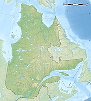
The Réserve écologique de Manche-d'Épée is a 573 hectare protected area established in 1984 in the south of the Canadian province of Québec in the regional county municipality of La Haute-Gaspésie in the Gaspésie region . It is located south of the village of Manche-d'Épée about 85 km east of Sainte-Anne-des-Monts . It serves to protect a valley basin with sugar maple forests.
The valley of the creek called Manche d'Épée is one of the south-northward running valleys that are common in the northern Gaspésie. Its streams flow into the St. Lawrence River . In the north, near the mouth of the stream, the basin widens to a diameter of 300 m at a depth of 20 m, but the gradient is very steep in the upper reaches, so that the cut is up to 400 m deep here.
The Appalachian rocks , to which the region belongs, are composed of limestone , slate, and clay slate. Under the influence of snow, ice and meltwater, the scree slopes and cones are subject to dynamic movements. The lower sections, however, are more stable. They are alluvial soils , i.e. young alluvial soils. The soils are regosol and brown earth of low strength, which drain well.
The flora is dominated by the typical tree species sugar maple and yellow birch . Among the ferns, the lance shield fern ( Polystichum lonchitis ), here called polystic faux-lonchitis , is particularly widespread. It is in danger of having to be included in the list of threatened species. In the higher zones, however, the paper birch is numerous, and mosses are also found. The Weymouth pine (pin blanc) and the occidental tree of life (French: Thuya occidental) are found in the highest and driest areas .
The Gaspésie became ice-free between 13,500 and 10,000 BP . Today's Manche-d'Épée reserve was freed from the ice sheet from the last Ice Age around 12,200 to 12,140 BP. As a result of the resulting relief, the region rose, with heavy scree discharges into the Goldthwait Sea . These severe erosion phenomena did not end until around 7,250 BP when forests stabilized the surface. This development has been delayed to this day by the scree that characterizes the steep valley.
At the beginning of the 19th century, Manche d'Épée found a knife that was sent to Philadelphia . Excavations brought to light the oldest traces of settlement dating back to around 6000 BC. Go back BC.
Web links
- Réserve écologique de Manche-d'Épée , government website
Remarks
- ↑ Mathieu Côté, JérômeThéau, Marie-Hélène Langis, Sylvain Fortin: Bilan forestier régional, Basé sur les connaissances Gaspésie - Les Îles , Consortium en foresterie Gaspésie-Les-Îles 2008, p. 67.
- ↑ Géographie physique et quaternaire , Presses de l'Université de Montréal, 2000, p. 30.
- ^ Bernard Hétu, James T. Gray: Effects of environmental change on scree slope development throughout the postglacial period in the Chic-Choc Mountains in the northern Gaspé Peninsula, Québec , in: Geomorphology 32,3-4 (2000) 335-355.
- ^ David Bailie Warden: Recherches sur les antiquités de l'Amérique Septentrionale , Paris 1827, p. 47.
- ^ Société de géographie (ed.): Recueil de voyages et de mémoires , Paris 1825, p. 416.

