Réservoir Manic 1
| Réservoir Manic 1 | |||||||||
|---|---|---|---|---|---|---|---|---|---|
|
|||||||||
|
|
|||||||||
| Coordinates | 49 ° 14 ′ 56 " N , 68 ° 24 ′ 0" W | ||||||||
| Data on the structure | |||||||||
| Construction time: | 1951-1966 | ||||||||
| Power plant output: | McCormick: 304 MW Manic-1: 184 MW |
||||||||
| Operator: | Hydro-Quebec , Alcoa | ||||||||
| Data on the reservoir | |||||||||
| Water surface | 12.5 | ||||||||
| Reservoir length | 14.5 | ||||||||
| Storage space | 3 700 000 m³ | ||||||||
| Catchment area | 45 800 km² | ||||||||
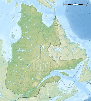
The Réservoir Manic 1 is a reservoir in the Canadian province of Québec .
It is located in the Côte-Nord region around the lower reaches of the Rivière Manicouagan . The area of the lake is 12.5 km², the length 14 km.
The dam Barrage McCormick ( ⊙ ) and the neighboring west location of the former dam Barrage Manic-1 ( ⊙ ) dam the river near its mouth three kilometers west of Baie-Comeau .
There are two storage power plants directly on the two dams . The McCormick hydropower plant was built between 1951 and 1953 and has an output of 304 MW . The power plant is owned by the state-owned energy utility Hydro-Québec and the aluminum group Alcoa , with a share of 60 and 40% respectively. Hydro-Québec owns the Manic-1 hydropower plant , built between 1964 and 1966 (output: 184 MW).
Together, the two hydropower plants with a capacity of 488 MW form the smallest power plant complex of the Manic Outardes project.
Individual evidence
- ^ Barrage McCormick. Commission de toponymie du Québec, accessed November 5, 2011 (French).
- ^ Barrage Manic-1. Commission de toponymie du Québec, accessed November 5, 2011 (French).
- ↑ Centrales hydroélectriques. Hydro-Québec, accessed November 5, 2011 (French).
- ^ Central McCormick. Commission de toponymie du Québec, accessed November 5, 2011 (French).
- ↑ Centrale Manic-1. Commission de toponymie du Québec, accessed November 5, 2011 (French).
