Río San Pedro de Inacaliri
| Río San Pedro de Inacaliri | ||
|
Río Pedro de Incaliri |
||
| Data | ||
| location |
|
|
| River system | Río Loa | |
| Drain over | Río Loa → Pacific Ocean | |
| Headwaters | north of the San Pedro de Collana volcano 21 ° 55 ′ 56 ″ S , 68 ° 5 ′ 20 ″ W |
|
| Source height | approx. 5214 m | |
| muzzle | in the Río Loa coordinates: 21 ° 57 ′ 55 ″ S , 68 ° 36 ′ 24 ″ W 21 ° 57 ′ 55 ″ S , 68 ° 36 ′ 24 ″ W. |
|
| Mouth height | 3021 m | |
| Height difference | approx. 2193 m | |
| Bottom slope | approx. 29 ‰ | |
| length | 76 km | |
| Catchment area | 9850 km² | |
| Right tributaries | Río Silala | |
|
Ojos de San Pedro |
||
The Río Pedro de Inacaliri is a river in the Atacama Desert in Chile , in the Región de Antofagasta . It has a length of 76 kilometers and flows largely in a westerly direction.
description
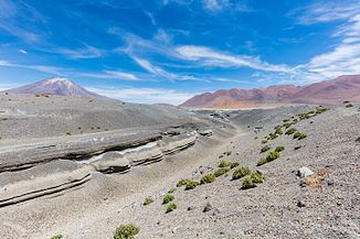
The river rises under the name Cajón in the western cordillera of the Chilean Andes , a few kilometers north of the Cerro de Colana from one of the rubble compartments of the northwest ridge of the Cordillera Occidental . As an endorheic body of water, it first flows about ten kilometers west and then another ten kilometers south, where it joins the Río Silala . Shortly after the merging of the two rivers, part of the river water, between 50 and 60 l / s, is diverted to the open copper mine in Chuquicamata , so that the river seeps into the river plain over the next eight kilometers and only another seven kilometers downstream into the so-called Ojos del San Pedro partially resurfaces. Further to the west, south of the San Pedro volcano, the river has dug itself up to a hundred meters deep into a 5 km² salt pan before it flows into the Río Loa west of the town of San Pedro .
literature
Hans Niemeyer Fernández: Hoyas hidrográficas de Chile . 2 a Región de Antofagasta. Ed .: Ministerio de Obras Públicas. Dirección General de Aguas. Santiago de Chile 1980 ( online (PDF; 4.4 MB) [accessed April 2, 2016]).
Web links
- Minería privada descarta impacto por pugna entre Chile y Bolivia por aguas In: Minería Chilena. June 7, 2016 ( Spanish ) (accessed September 25, 2016)
- Dónde queda el Silala y por qué Bolivia se lo disputa a Chile In: BBC Mundo March 28, 2016 ( Spanish ) (accessed September 25, 2016)

