Ranwu Tso
|
Ranwu Tso Rawok Tso |
||
|---|---|---|

|
||
| Geographical location | Circle Baxoi the prefecture-level city Qamdo in Tibet ( China ) | |
| Tributaries | Parlung Zangbo | |
| Drain | Parlung Zangbo | |
| Location close to the shore | Ranwuzhen | |
| Data | ||
| Coordinates | 29 ° 27 '15 " N , 96 ° 47' 27" E | |
|
|
||
| Altitude above sea level | 3850 m | |
| surface | 5 km² | |
| length | 7 km | |
| width | 1 km | |
The Ranwu Tso (or Rawok Tso ) is a small glacial rim lake in the southeast of the Tibet Autonomous Region ( PR China ).
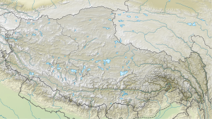
The lake is located in the district Baxoi the prefecture-level city Qamdo . It has an area of 5 km² and is at an altitude of 3850 m . The upper reaches of the Parlung Zangbo flows through the 7 km long elongated lake in a north-westerly direction. At the southern end of the lake lies the confluence of the Parlung Zangbo, which is fed 15 km up the valley by the Lhegu glacier . To the west of it, several glaciers end on the lake shore. Down the valley, 3.7 km further west, is the neighboring lake, Anmu Tso .
The G318 national road , which connects Sichuan with Tibet, runs a few kilometers northwest of the lake. This makes the lake relatively easy to access for tourists.
Web links
- Photo at tibettravel.org
