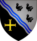
Reckingen / Mess
| coat of arms | map |
|---|---|

|

|
| Basic data | |
| State : |
|
| Coordinates : | 49 ° 34 ' N , 6 ° 0' E |
| Canton : | Esch on the Alzette |
| Residents : | 2511 (January 1, 2019) |
| Area : | 20.4 km² |
| Population density : | 123 inhabitants / km² |
| Municipality number: | 0210 |
| Website: | www.reckange.lu |
| politics | |
| Mayor: | Carlo Muller |
| Elective system : | Majority vote |
Reckingen / Mess ( Luxembourgish Reckeng op der Mess , French Reckange-sur-Mess ) is a municipality in the Grand Duchy of Luxembourg and belongs to the canton of Esch an der Alzette .
Composition of the community
The municipality of Reckingen / Mess consists of the following localities:
- Ehlingen
- Limpach
- Pissing
- Reckingen / Mess
- Roedgen
- Wickring
history
The village of Reckingen, now the main village of the municipality, has existed since the 10th century. Until the French Revolution , the villages of what is now Reckingen belonged to various “houses” as well as the monasteries of Münster and Marienthal. The community has existed in its current form since 1784. Between 1823 and 1856, Leudelange also belonged to the Reckingen community.
Lollingen and Rüssingen
Lollingen (Lallengerhaff) was the seat of a knight family. This transferred their property to the Marienthal monastery. Today there are no more remains of the “Lallengerhaff”.
Rüssingen is a village near Reckingen that has been extinct since the 17th century. Until the 18th century, only the church remained, but it also fell apart in the end. Until recently, a cross reminded of the former location.