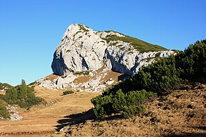
Talking stone
| Talking stone | ||
|---|---|---|
| height | 1900 m above sea level A. | |
| location | Styria , Austria | |
| Mountains | Dead Mountains | |
| Coordinates | 47 ° 41 '23 " N , 13 ° 53' 12" E | |
|
|
||
| rock | Schrammbach layers (various limestone ) | |
| Normal way | Hike | |
The Redende Stein is 1900 m above sea level. A. high mountain in Styria , in the west of the Dead Mountains . The Redende Stein is located at the west end of a long, drawn-out mountain ridge that stretches in a west-east direction towards the Widderkarkogel, the end of which it ends with a characteristic rocky peak. There is a multiple echo on the north side. The closest refuge is the Albert-Appel-Haus of the Austrian Tourist Association .
ways
The summit can be climbed via a short path that branches off from the Austrian long-distance hiking trail (No. 201) (also corresponds to the purple path of the Via Alpina and the European long-distance hiking trail E4 Alpin ). The simplest and most popular variant consists of a one-hour climb from the nearby Albert-Appel-Haus .
Literature & Maps
- Ludwig Krenmayr, Gernot Rabeder, Gisbert Rabeder: Alpine Club Leader Totes Gebirge (= Alpine Club Leader. Series: Northern Limestone Alps ). RZ 60–63 and 155–157. 3rd, revised edition. Bergverlag Rudolf Rother, Munich 1982, ISBN 3-7633-1244-7 .
- Wolfgang Heitzmann: Salzkammergut with the Totem Mountains and Dachstein: high-altitude trails, summit tours, via ferratas . Tour No. 46, pp. 182-185. New edition Bruckmann Verlag, Munich 2002, ISBN 3-7654-3336-5 .
- ÖK 50 sheet 97 (Bad Mitterndorf).
- Alpine Club Map Bl. 15/1 (Totes Gebirge - West), 1: 25,000; Austrian Alpine Club 2014; ISBN 978-3-928777-29-2 .

