Refshaleøen
| Refshaleøen | ||
 Refshaleøen as seen from the harbor. |
||
| Geographical location | ||
|
|
||
| Coordinates | 55 ° 41 '35 " N , 12 ° 37' 0" E | |
| Waters 1 | Oresund | |
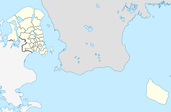
Refshaleøen is a peninsula in the port area of Copenhagen . From 1868 the port administration raised it as an island and expanded it several times. Today it forms the northern tip of the island of Amager .
Its name is derived from the elongated shoal Rævshale (in German "fox tail") on which the island was formed. This shoal initially protected the castle from Copenhagen to the east against incoming enemy ships.
In the 19th century Refshaleøen developed into an industrial location. In 1868 the port administration had soil filled up, and in 1872 the Burmeister & Wain shipyard settled . She rose to become one of the city's most important employers. In its heyday, the shipyard employed around 8,000 people. A proud chapter in Danish industrial history ended with bankruptcy in 1996.
Since then, Refshaleøen has been subject to much-noticed urban planning changes. Buildings were refurbished and gave companies in the creative and craft sectors a new home. Flea markets, cultural life and gastronomy established themselves. The space company Copenhagen Suborbitals has been based here since 2008 . The heavy metal festival Copenhell has been held on the site since 2010. Since April 2011, the Lynetten Yacht Club has again a shipyard for all types of motor boats with Yacht Service Knudsen .
Web links
- Refshaleøen.dk Cultural projects and exhibitions (English)
Individual evidence
- ↑ Refshaleøen lex.dk, accessed on August 3, 2020.
- ↑ De bastionære fæstninger 1600-1870 ( Danish ) Selskabet for København's history. Archived from the original on September 21, 2013. Retrieved on August 3, 2020.
- ↑ Mens vi venter på Refshaleøen ( Danish ) Christianshavnernet. Retrieved August 3, 2020.
