Rhode Island (island)
| Rhode Island (Aquidneck Island) |
||
|---|---|---|
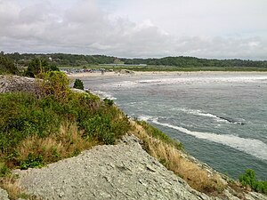
| Second Beach ( Middletown ) | ||
| Waters | Narragansett Bay , Atlantic Ocean | |
| Geographical location | 41 ° 33 ′ N , 71 ° 16 ′ W | |
|
|
||
| length | 24 km | |
| width | 8 kilometers | |
| surface | 98 km² | |
| Highest elevation | Slate Hill 79 m |
|
| Residents | 60,870 (2000) 621 inhabitants / km² |
|
| main place | Newport | |
Rhode Island (unofficially also often Aquidneck Island ) is the largest island in Narragansett Bay and belongs to County Newport in the US state of Rhode Island .
The island is 24 km long and 8 km wide and has a population of around 60,000. The largest town on the island is the town of Newport , the rest is divided between the parishes of Middletown and Portsmouth . The island can be reached from the mainland via several bridges. In the north the Mount Hope Bridge connects the island with the city of Bristol , in the northeast the Sakonnet River Bridge forms a connection to the mainland. South of the Sakonnet River Bridge, another bridge, the Stone Bridge, used to run, but this was destroyed by Hurricane Caroll in 1954 and has since been replaced by a ferry service. On the west side of the island, the Claiborne Pell Newport Bridge connects it with the neighboring island of Conanicut Island , which is connected to the mainland by another bridge.
There are also two colleges on the island, Salve Regina University and Naval War College .
literature
- Frederic Denlson, Narragansett Sea and Shore , (JA & RA Reid, Providence, RI., 1879)
- George L. Seavey, Rhode Island's Coastal Natural Areas.

