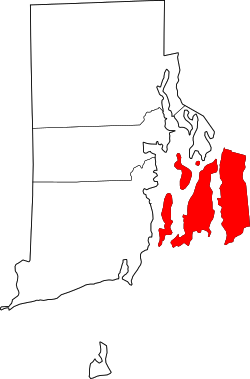
Newport County, Rhode Island
 Newport County Courthouse |
|
| administration | |
|---|---|
| US state : | Rhode Island |
| Administrative headquarters : | Newport |
| Foundation : | 1703 |
| Demographics | |
| Residents : | 82,358 (2014) |
| Population density : | 308.5 inhabitants / km 2 |
| geography | |
| Total area : | 813 km² |
| Water surface : | 546 km² |
| map | |
Newport County is a county in the state of Rhode Island in the United States . In 2014, the county had 82,358 residents and a population density of 313 people per square kilometer. The county seat is Newport .
geography
The county has an area of 812 square kilometers, of which 543 square kilometers are water. It borders Bristol County to the east . The county consists of the islands of Aquidneck Island , Conanicut Island and Prudence Island as well as the part of the mainland belonging to the east of Rhode Island. The highest point in the county is 98 m. ü. M. on Pocasset Hill in Tiverton.
The county is bordered to the north by Bristol County , to the east by the county of the neighboring state of Massachusetts, also called Bristol County , and to the west by Washington County .
history
Newport County was founded as Rhode Island County on June 22, 1703 and renamed Newport County on June 16, 1729 . The name goes back to the English city of Newport .
24 locations in the county have National Historic Landmark status . 120 buildings and sites in the county are listed on the National Register of Historic Places (NRHP) (as of July 25, 2018).
Population development
| 1980 | 1990 | 2000 | 2010 |
|---|---|---|---|
| 81,383 | 87,194 | 85,433 | 82,888 |
Demographics
According to the 2000 census , Newport County's population was 85,433 in 35,228 households and 22,228 families. The population was composed of 91.46 percent white, 3.73 percent black and 1.23 percent Asian. 2.82 percent of the population were Hispanic or Latino of any race. The per capita income was $ 26,779; 5.4 percent of families and 7.1 percent of the population lived below the poverty line .
cities and communes
Individual evidence
- ^ Newport County in the Geographic Names Information System of the United States Geological Survey . Retrieved February 22, 2011
- ↑ Charles Curry Aiken, Joseph Nathan Kane: The American Counties: Origins of County Names, Dates of Creation, Area, and Population Data, 1950-2010 . 6th edition. Scarecrow Press, Lanham 2013, ISBN 978-0-8108-8762-6 , p. 222 .
- ↑ Listing of National Historic Landmarks by State: Rhode Island . National Park Service , accessed July 25, 2018.
- ↑ Search mask database in the National Register Information System. National Park Service , accessed July 25, 2018.
- ^ Newport County, Rhode Island , 2000 census data sheet at factfinder.census.gov .
Web links
Coordinates: 41 ° 31 ′ N , 71 ° 16 ′ W

