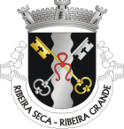
Ribeira Seca (Ribeira Grande)
| Ribeira Seca | ||||||
|---|---|---|---|---|---|---|
|
||||||
| Basic data | ||||||
| Autonomous Region : | Azores | |||||
| Concelho : | Ribeira Grande | |||||
| Coordinates : | 37 ° 49 ′ N , 25 ° 32 ′ W | |||||
| Residents: | 2950 (as of June 30, 2011) | |||||
| Surface: | 12.59 km² (as of January 1, 2010) | |||||
| Population density : | 234 inhabitants per km² | |||||
Ribeira Seca is a municipality ( freguesia ) in the Portuguese district of Ribeira Grande . It has 2950 inhabitants (as of June 30, 2011).
history
On June 2, 1563, the town was destroyed by an eruption of the Pico do Sapateiro. This is reminiscent of a fountain that was buried during the eruption and was discovered by chance during construction work in the 20th century and later uncovered opposite the Igreja de São Pedro parish church .
Individual evidence
- ↑ a b www.ine.pt - indicator resident population by place of residence and sex; Decennial in the database of the Instituto Nacional de Estatística
- ↑ Overview of code assignments from Freguesias on epp.eurostat.ec.europa.eu
- ↑ Susanne Jaep: Azores 36. Ostfildern 1998
Web links
Commons : Ribeira Seca - collection of images, videos and audio files


