Rice Lake (Trent River)
| Rice Lake | ||
|---|---|---|
| Geographical location | Ontario (Canada) | |
| Tributaries | Otonabee River , Indian River | |
| Drain | Trent River | |
| Islands | Cow Island | |
| Places on the shore | Bewdley , Gores Landing , Hastings , Bailieboro , Roseneath | |
| Location close to the shore | Peterborough | |
| Data | ||
| Coordinates | 44 ° 10 ′ N , 78 ° 11 ′ W | |
|
|
||
| Altitude above sea level | 187 m | |
| surface | 91.56 km² | |
| length | 37 km | |
| width | 4.8 km | |
| Maximum depth | 13.4 m | |

|
||
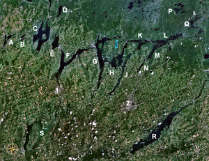
| Rice Lake (letter "R") south of the Kawartha Lakes | ||
Rice Lake is a lake in the southeast of the Canadian province of Ontario .
The lake is south of the city of Peterborough and north of Cobourg . The lake is part of the Trent-Severn waterway . This runs from the Georgsbucht of the Huron Lake over the Kawartha Lakes and the Otonabee River to Rice Lake and over the Trent River on to Lake Ontario .
Rice Lake is 37 km long and 4.8 km wide. The natives called the lake "Pemadashdakota" ("Lake of the Burning Plains").
A drumlin field extends northwest of the lake. Some of the islands in Rice Lake are partially flooded drumlins.
Rice Lake divides the Oak Ridges moraine by means of three wedges in the west ( Albion , Uxbridge and Pontypool ) and one wedge in the east ( Rice Lake ), which ends in the Trent River. A narrow corridor south of Rice Lake connects these wedges.
The lake is pretty shallow. It was named after the water rice that used to grow in the lake and was harvested by the natives of the area. Much of the water rice, which was originally widespread in the lake, disappeared when the water level was raised due to the construction work to build the waterway.
The place Bewdley is located at the west end of the lake. The city of Hastings is on the east bank of the lake.
Prehistoric burial mounds were discovered in Serpent Mounds Park on the north shore of Rice Lake. Other sights on the lake are the Indian reservations of the Alderville and Hiawatha First Nations . Other places on the lake include Roseneath , Bailieboro , Gores Landing and Harwood .
The Cobourg and Peterborough Railway was completed in 1854. She crossed Rice Lake from Harwood to Hiawatha. The thick ice floes on the lake in winter damaged the bridge so badly that traffic was stopped within six years. Sections of the railway line can still be seen at the lake.
A passenger steamboat sailed the lake in the late 19th century.
Rice Lake is a well known tourist destination and popular with anglers. An annual fishing competition is held at Rice Lake. In the lake u. a. Catched the following fish: eyeglass , muscle lung , largemouth bass , black bass , American perch , crappie and sunfish .
Islands
Cow Island , Black Island, Foley Island (Upper and Lower), Grasshopper Island, Grape Island (East and West), Harmony Island, Harris Island, Hickory Island, Long Island, Margaret Island, Paudaush Island, Rack Island, Sheep Island, Spook Island, Sugar Island (East and West), Tic Island and White's Island.
Web links
- Northumberland Tourism - Fishing Rice Lake - Walleye, Bass, Crappie, Perch, Panfish and Muskie
- Fishing on Rice Lake Walleye, Bass, Crappie, Perch, Panfish and Muskie
