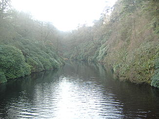
River Goyt
| River Goyt | ||
|
River Goyt |
||
| Data | ||
| location | Derbyshire and Greater Manchester , England | |
| River system | River Mersey | |
| Drain over | River Mersey → Irish Sea | |
| source | in the moors of Ax Edge , approximately 53 ° 14 ′ 24 " N , 1 ° 59 ′ 34" W |
|
| Source height | 520 m ASL | |
| confluence | in Stockport with the Tame zum Mersey Coordinates: 53 ° 24 ′ 52 " N , 2 ° 9 ′ 24" W 53 ° 24 ′ 52 " N , 2 ° 9 ′ 24" W |
|
| Mouth height | 40 m ASL | |
| Height difference | 480 m
|
|
| Right tributaries | River Etherow | |
| Reservoirs flowed through | Errwood Reservoir, Fernilee Reservoir | |
The River Goyt is a river in north-west England and - together with the Etherow and the Tame - one of the three headwaters of the Mersey . Its source is in the Ax Edge moors in an area known as the Upper Goyttal. After its union with the Etherow, it flows together with the Tame at Stockport and then continues to flow as the Mersey.
Individual evidence
- ↑ Environment Agency : The Tame, Goyt and Etherow catchement abstraction management strategy ( English , PDF) Environment Agency North West, Warrington. S. March 6, 2004. Archived from the original on September 27, 2007. Info: The archive link was automatically inserted and not yet checked. Please check the original and archive link according to the instructions and then remove this notice. Retrieved March 13, 2007.
- ↑ Boyce, D: Mersey and Bollin Catchment abstraction management strategy ( English , PDF) Environment Agency North West, Warrington. S. August 5, 2005. Archived from the original on September 27, 2007. Info: The archive link has been inserted automatically and has not yet been checked. Please check the original and archive link according to the instructions and then remove this notice. Retrieved August 21, 2010.
Web links
Commons : River Goyt - collection of images, videos and audio files
