River Mint
| Mint | ||
|
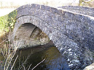
A bridge over the River Mint east of Kendal |
||
| Data | ||
| location | Cumbria , England | |
| River system | River Kent | |
| Drain over | River Kent → Morecambe Bay | |
| River basin district | North West | |
| source | Confluence of Kidshowe Beck , Wolfhowe Gill and Ashstead Beck 54 ° 24 ′ 37 ″ N , 2 ° 41 ′ 36 ″ W |
|
| muzzle | in the River Kent coordinates: 54 ° 20 ′ 33 " N , 2 ° 44 ′ 40" W 54 ° 20 ′ 33 " N , 2 ° 44 ′ 40" W.
|
|
| Left tributaries | Bannisdale Beck | |
| Small towns | Kendal | |
The River Mint is a river in Cumbria , England .
The River Mint is formed from the confluence of the Kidshowe Beck , Wolfhowe Gill and Ashstead Beck . It first flows in a south-easterly direction and then describes an arc in a south-westerly direction to flow into the River Kent on the northern edge of Kendal .
swell
- Kendal, Morecambe, Windermere & Lancaster (= Landranger Map . Band 97 ). Ordnance Survey , Southampton 2011, ISBN 978-0-319-23208-8 .
