Robert H. Treman State Park
|
Robert H. Treman State Park
|
||
| location | Ithaca , Enfield , Newfield ; New York (State) , United States | |
| surface | 4.5 | |
| Geographical location | 42 ° 24 ' N , 76 ° 34' W | |
|
|
||
| Setup date | 1920 | |
| administration | New York State Office of Parks, Recreation and Historic Preservation | |
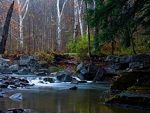
Robert H. Treman State Park is a state park in the parish of Ithaca , Enfield, and Newfield , part of the Finger Lakes Region . The park covers 1,110 acres (4.5 km²). It is one of the parks in Tompkins County known for its waterfalls.
history
Treman purchased land around Enfield Falls in 1915 and had over 1,000 trees planted. Together with his wife, Laura Treman, he donated the land to New York State in 1920 so that Enfield Glen State Park should be established. In 1937 the park was given its current name in honor of Robert H. Treman when he died.
The Enfield Falls Mill and Miller's House buildings were added to the National Register of Historic Places in 1979.
geography
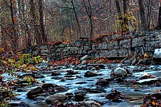
The state park is located southwest of Ithaca. Today State Route 327 runs along its northern boundary and State Routes 13 , 34, and 96 run along its east side . The park stretches along the deeply cut Enfield Glen . The westernmost point is near the confluence of Fish Kill with Enfield Creek, and soon thereafter the river tumbles over Lucifer Falls , a waterfall with various sections and a total height of 115 ft (35 m). There are other cascades in the gorge, the easternmost of which is the Lower Falls near Route 13.
Freetime activities
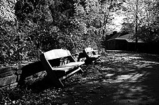
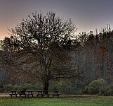
The Gorge Trail and Rim Trail (4.5 mi, 7.2 km) offer scenic views of the gorge, but are closed in winter due to snow and slipperiness. There is also a natural swimming pool in the park, picnic areas, playgrounds and camping facilities.
gallery
See also
Individual evidence
- ^ Geographic Names Information System . United States Geological Survey.
- ^ NYS Office of Parks, Recreation and Historic Preservation: State Park Acquisition Record and Document Review. [1] 2010: 17.
- ↑ 2014 New York State Statistical Yearbook. Archived copy ( memento of the original from September 16, 2015 in the Internet Archive ) Info: The archive link was inserted automatically and has not yet been checked. Please check the original and archive link according to the instructions and then remove this notice. The Nelson A. Rockefeller Institute of Government 2014: Section O: Environmental Conservation and Recreation, Table O-9, 673.
- ^ A b Fifty Years: New York State Parks, 1924-1974. [2] : 10, Natural Heritage Trust 1975.
- ↑ Susan Thompson; Carol Kammen: Place Names of Tompkins County. Office of the Tompkins County Historian, Ithaca, NY 2004: 49. [3] 2015.
- ^ National Register Information System . In: National Register of Historic Places . National Park Service . Retrieved March 13, 2009.
- ^ US Geological Survey. National Hydrography Dataset high-resolution flowline data. The National Map .


