Roschen Peninsula
| Roschen Peninsula | ||
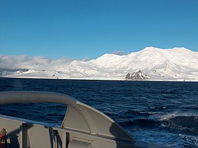
 View from Bransfield Street to the Roschen Peninsula |
||
| Geographical location | ||
|
|
||
| Coordinates | 62 ° 43 ′ 0 ″ S , 60 ° 15 ′ 0 ″ W | |
| Waters 1 | Brunow Bay , Chavei Cove and Bransfield Street | |
| Waters 2 | False Bay | |
The Rozhen Peninsula ( Bulgarian Полуостров Рожен Poljostrow florets ) is a 9km long and Barnard Point expiring peninsula on the south coast of Livingston Island in the archipelago of the South Shetland Islands . It separates Brunow Bay , Chavei Cove and Bransfield Strait in the southeast from False Bay in the west.
Mapping was carried out by British scientists in 1968, by Spanish scientists in 1991 and by Bulgarian scientists from 1995 to 1996. The Bulgarian Commission for Antarctic Geographical Names named the peninsula in 2002 after the Roschen Monastery in Bulgaria.
Web links
- Rozhen Peninsula in the Composite Gazetteer of Antarctica (English)
