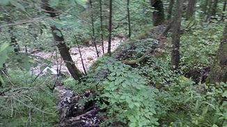
Rottauer Bach
| Rottauer Bach | ||
|
Rottauer Bach in the Rottauer Valley |
||
| Data | ||
| location | Upper Bavaria | |
| River system | Danube | |
| Drain over | Bernauer Achen → Alz → Inn → Danube → Black Sea | |
| Source height | 1353 m | |
| muzzle |
Bernauer Achen coordinates: 47 ° 47 '43 " N , 12 ° 24' 28" E 47 ° 47 '43 " N , 12 ° 24' 28" E |
|
| Mouth height | approx. 547 m | |
| Height difference | approx. 806 m | |
| Bottom slope | approx. 15% | |
| length | approx. 5.3 km | |
The upper reaches of the Bernauer Achen above Rottau in the Rottauer Valley are called Rottauer Bach . The brook arises between Kampenwand and Hochplatte , flows north in the Rottauer Valley to Rottau and is called Bernauer Ache from there.
