Ruacana Falls
| Ruacana Falls | ||
|---|---|---|
|
Ruacana Falls (2011) |
||
| Coordinates | 17 ° 24 ′ 0 ″ S , 14 ° 13 ′ 0 ″ E | |
|
|
||
| place | at Ruacana | |
| height | Falling edge : 107 m | |
| width | 1067 m | |
| Mean flow rate (MQ) | 283 m³ / s | |
| flow | Kunene | |
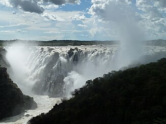
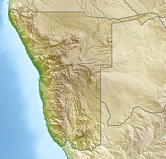
The Ruacana Falls are a waterfall of the Namibian - Angolan border river Kunene , which plunges up to 107 meters deep into a gorge up to 1067 meters wide during the rainy season.
The falls are named after the nearby town of Ruacana . Directly at the waterfall underground scale Ruacana hydropower plant . It was originally built in the 1970s as part of the Cunene project and is Namibia's largest power plant.
Due to the strong seasonal fluctuations in the water level and the use of river water to generate electricity, the waterfall only offers an impressive spectacle during floods, often towards the end of the rainy season in March and April, or when the locks are open.
See also
Web links
Commons : Ruacana Falls - Collection of Images, Videos, and Audio Files
Individual evidence
- ↑ Ruacana Falls. World Waterfall Database. Retrieved May 29, 2017.
- ^ Ruacana Power Station. Nampower. Retrieved July 22, 2020.

