Rue Duret
Coordinates: 48 ° 52 ' N , 2 ° 17' E
| Rue Duret | |
|---|---|
| location | |
| Arrondissement | 16. |
| quarter | Chaillot |
| Beginning | 48, Avenue Foch |
| The End | 61bis, Place du Général-Patton |
| morphology | |
| length | 310 m |
| width | 12 m |
| history | |
| designation | August 10, 1868 |
| Original names | Route départementale 10 Rue de la Pompe |
| Coding | |
| Paris | 3069 |
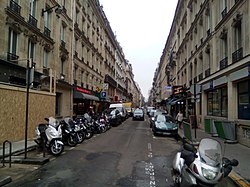
The Rue Duret is a 310 meter long and 12 meter wide street in the Quartier de Chaillot in the 16th arrondissement .
The street starts at number 48, avenue Foch and ends at number 61 to Place du Général Patton .
Name origin
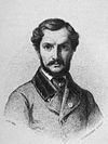
Before the street was given its current name in 1868 in honor of the sculptor Francisque Joseph Duret (1804-1865), it was part of the Rue de la Pompe, which now only runs south of Avenue Foch .
history
After the parish of Passy was incorporated into Paris, this road became Route départementale 10. On May 23, 1863, it was officially incorporated into the Paris road system as part of the Rue de la Pompe and became "independent" on August 1, 1868 under its current name .
Individual evidence
- ^ Engraving by M. La Guillermie based on a drawing by Pierre Auguste Cot

