Sätofta
| Sätofta | ||||
|
||||
| State : | Sweden | |||
| Province (län): | Skåne County | |||
| Historical Province (landskap): | Gentle | |||
| Municipality : | Listen | |||
| Coordinates : | 55 ° 54 ' N , 13 ° 33' E | |||
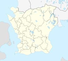
Sätofta is a district of Höör in the municipality of the same name in the southern Swedish province of Skåne län or the historic province of Skåne .
It is a good two kilometers south of the center of Höör on the lake Östra Ringsjön (also Sätoftasjön ). The Riksväg 23 from Malmö to Oskarshamn leads west to Sätofta over.
Before 2015, Sätofta was an independent crime scene with last (2010) 1348 inhabitants, until it actually merged with Höör via the residential areas Ekeborg and Ekbacken in between.
Individual evidence
- ↑ Befolkning i tatorter 1960–2010 on the website of Statistiska centralbyrån (Excel file)
