Sabalana Islands
| Sabalana Islands | ||
|---|---|---|
| Waters | Lake Flores | |
| archipelago | Malay Archipelago | |
| Geographical location | 6 ° 50 ′ S , 119 ° 1 ′ E | |
|
|
||
| Number of islands | over 20 | |
| Main island | Sabalana | |
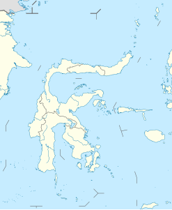
The Sabalana Islands ( Indonesian Kepulauan Sabalana , formerly Postillon Islands ) are an Indonesian group of islands in the Flores Sea . They are halfway between Sulawesi (Celebes) in the north and Sumbawa in the south.
geography
The islands belong to the district ( Indonesian Kecamatan ) Liukang Tangaya in the administrative district ( Indonesian Kabupaten ) Pangkajene dan Kepulauan of the province of South Sulawesi ( Indonesian Sulawesi Selatan ).
The archipelago has a width and length of 45 kilometers each. The location of the islands can be compared to the shape of a saxophone . In the southeast there is a shoal measuring 20 × 8 kilometers. On this is Sabalana , the largest island in the archipelago and one of the largest atolls in the country. To the southeast are the islands of Pamolikang , Pattayangang and Gusung Bira , to the northeast are Banawaya , Lilikang and Gusung Lilikang . To the southwest stretches a chain of islands with Sanana Kecil and Sanana Besar , Meong , Matalaang (Matalang), Balaloho (Balalohong), Manukang , Sadulangang and a good distance away the islet of Sarege . To the south of this chain are the islands of Suruabu (Soroabu) and Santigiang . Another chain of islands with Laiya (Laija), Makarangana (Makarangang), Sumanga , Balobaloang Kecil , Balobaloang Besar , Sabaru and finally Jailamu (Djailamu) in the extreme northwest extends from Sabalana to the northwest. To the south of Balobalong Besar are the islands of Pelokang and Longko .
In two regions in the west of the archipelago there are larger reefs that reach between 8 and 20 meters to the surface and are called Taka in Indonesian . The open waters in the south and west are also relatively shallow with a depth of 55 meters. On the east and south-east sides, the reefs gradually drop to depths below 546 m. The lowest point is 3089 meters, about 50 kilometers southeast of the archipelago.
The Sabalena Islands form the eleventh largest coral reef in the world. It has a diverse flora and fauna. Illegal dynamite and poison fishing damage them seriously. While local fishermen usually follow strict rules to preserve fish stocks, foreign fishermen bribe corrupt officials with "protection money" so that they can use their destructive methods.
Residents
The administrative village ( desa ) Sabalana , to which the islands south of Makarangana are assigned, has 3,609 inhabitants (2010 census). In Kepulauan Balo Baloang to the Balobaloang Besar, Balobaloang Kecil, Sumanga, Pelokang and Longko include 3,059 people. 884 people live in Desa Sabaru , with Sabaru and Jailamu.
The inhabitants of the two Balobaloang Islands are traditional Bugis traders who sail the waters with their sailing boats. The inhabitants of Sumanga, ethnic Macassarians , are commercial fishermen. They started dynamite fishing during the Japanese occupation in World War II to increase their yields. The ammunition left behind by the Japanese was used. Poison is used by fishermen from the vicinity of Makasar who use the port of Sumanga. The few fishermen from Balobaloang who fish for their own needs and only partially for resale use neither dynamite nor poison and therefore achieve a smaller catch.
Individual evidence
- ↑ Deutsche Seewarte: Sea Handbook for the Indian Ocean , p. 58 , 2013.
- ↑ a b Penduduk Indonesia menurut desa 2010 ( Memento from March 27, 2014 in the Internet Archive ) (Indonesian; PDF; 6.0 MB), accessed on January 26, 2013
- ↑ a b c d e f Hlavacs, Lauri A .: Mapping the Effects of Blast and Chemical Fishing in the Sabalana Archipelago, South Sulawesi, Indonesia, 1991-2006 , 2008.
- ↑ Reef base: Resources - Coral Reefs , accessed November 17, 2016.
- ↑ Mapcarta: Kepulauan Sabalana , accessed on November 17, 2016.
- ↑ Gene Ammarell: Whither Southeast Asia in the Anthropocene? , The Journal of Asian Studies / Volume 73 / Issue 04 / November 2014, pp 1005 - 1007, doi : 10.1017 / S0021911814001594 , from November 20, 2014.
