Sistema Sac Actun
| Sistema Sac Actun
|
||
|---|---|---|
|
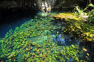
Grand Cenote : starting point for exploration |
||
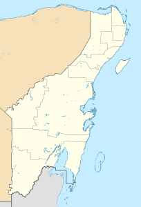
| Location: | Quintana Roo , Mexico | |
|
Geographic location: |
20 ° 14 '47.3 " N , 87 ° 27' 50.5" W | |
|
|
||
| Geology: | limestone | |
| Type: | Water cave, stalactite cave | |
| Discovery: | November 26, 1987 | |
| Overall length: | 364.48 kilometers (underwater) 371.958 kilometers (total) |
|
| Level difference: | −119.2 meters | |
| Particularities: | world's longest underwater cave | |
Sac Actun ( Mayathan sak aktun , white cave; officially Sistema Sac Actun ) is an underground river system on the Yucatán Peninsula in Mexico . At 372.0 km, it is the longest known underwater cave system in the world. It is connected to the surface by 226 cenotes ; the greatest depth is in The Blue Abyss at 119.2 m.
In August 2012, a connection to the 82.4 km long Sistema Dos Ojos in the Nohoch Nah Chich area was found via a dry passage . Including all overwater parts (7.5 km) the total length is 372 km; thus Sac Actun / Dos Ojos is the world's second longest cave system.
Web links
Individual evidence
- ↑ a b c Long underwater caves in Quintana Roo Mexico. In: Quintana Roo Speleological Survey . National Speleological Society , July 18, 2019, accessed November 22, 2019 .
- ^ A b Dry Caves and Sumps of Quintana Roo Mexico. In: Quintana Roo Speleological Survey. National Speleological Society, July 21, 2019, accessed November 22, 2019 .
- ↑ Bob Gulden, Jim Coke: World longest underwater caves. In: Geo2 Committee on Long and Deep Caves. National Speleological Society (NSS), October 1, 2019, accessed November 22, 2019 .
- ^ John Roach: World's Longest Underground River Discovered in Mexico. In: National Geographic News. National Geographic , March 5, 2007, accessed June 30, 2013 .
- ^ Bob Gulden: Worlds longest caves. In: GEO2 Committee on long and deep caves. NSS, October 1, 2019, accessed November 22, 2019 .

