
Samoyovich Island
| Samoyovich Island | ||
|---|---|---|
| Waters | Kara Sea | |
| Archipelago | Severnaya Zemlya | |
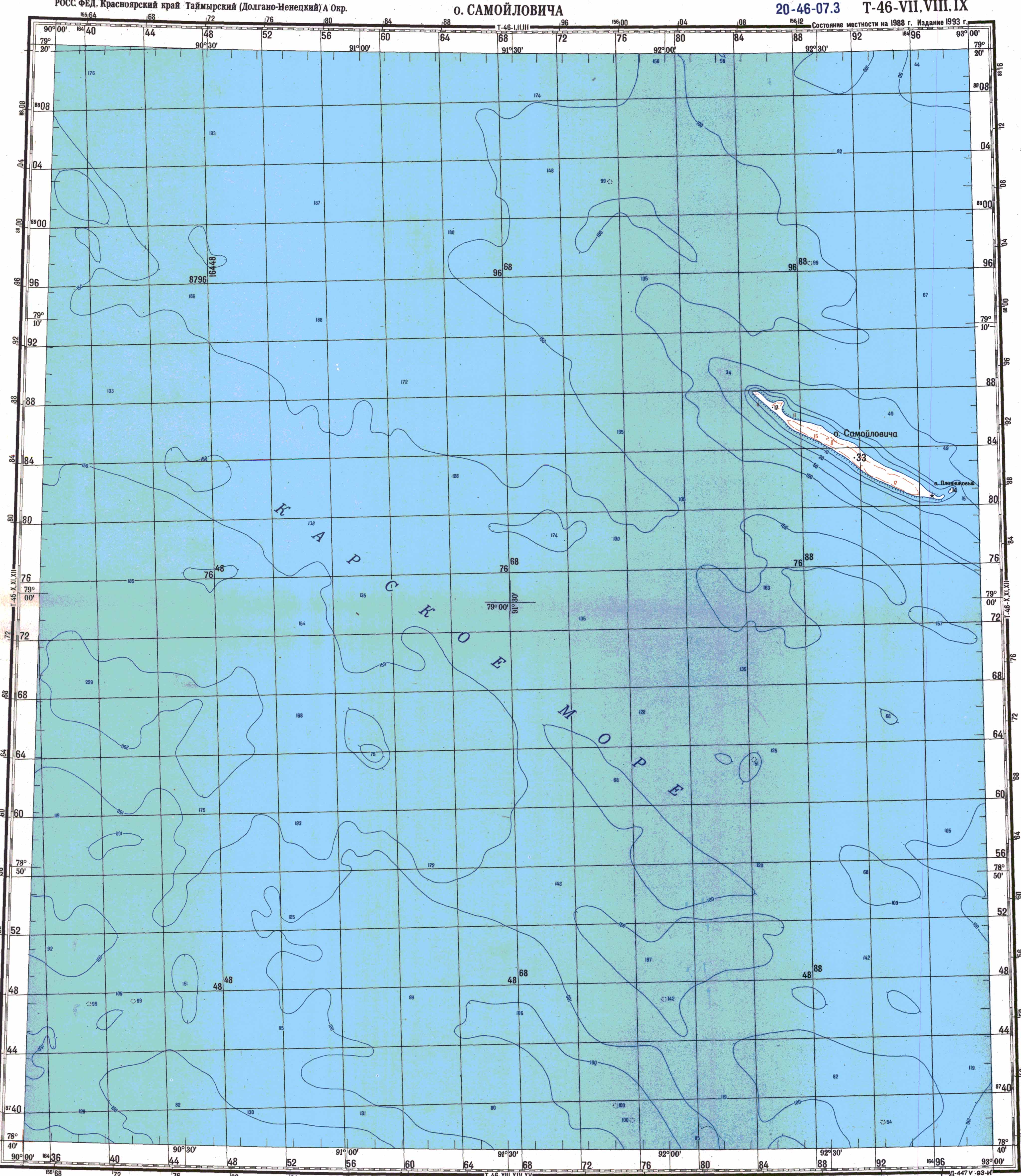
| Geographical location | 79 ° 5 ' N , 92 ° 35' E | |
|
||
| length | 15 km | |
| width | 1.1 km | |
| surface | 12 km² | |
| Highest elevation | 33 m | |
| Residents | uninhabited | |
 |
||

The Samoilovich Island ( Russian Остров Домашний ) belongs to the Severnaya Zemlya archipelago in the Russian Arctic .
It is located about 35 km west of the October Revolution Island and 35 km south of the Sedov Islands . The island is 15 kilometers long, but only a little over a kilometer wide. Its area is 12 km² and its greatest height 33 m . The surface of the island is characterized by a steeply sloping southwest coast to the open Kara Sea and a flat northeast coast.
Samoyovich Island was discovered in 1930 by an expedition led by Otto Schmidt with the icebreaker Georgi Sedow and named after the Russian-Soviet polar explorer and geologist Rudolf Samoyovich . When he was executed in the course of Stalin's " Great Purge " in 1938 , its name was changed to "Long Island" (Остров Длинный, Ostrow Dlinny). In 1965 it got its original name back.
Web links
- Topographic map T-46-VII, VIII, IX on a scale of 1: 200,000
Individual evidence
- ↑ Samoilowitscha in the dictionary of geographical names (Russian)
Islands: Bolshevik | Domaschni | Golomjanny | Komsomolets | Krupskoi | October Revolution | Pioneer | Samoilovich | Schmidt | Starokadomski | Taimyr
Archipelago: Sedov