
Schmidt Island
| Schmidt Island | ||
|---|---|---|
 (in the Severnaya Zemlya archipelago ) |
||
| Waters | Arctic Ocean | |
| Archipelago | Severnaya Zemlya | |
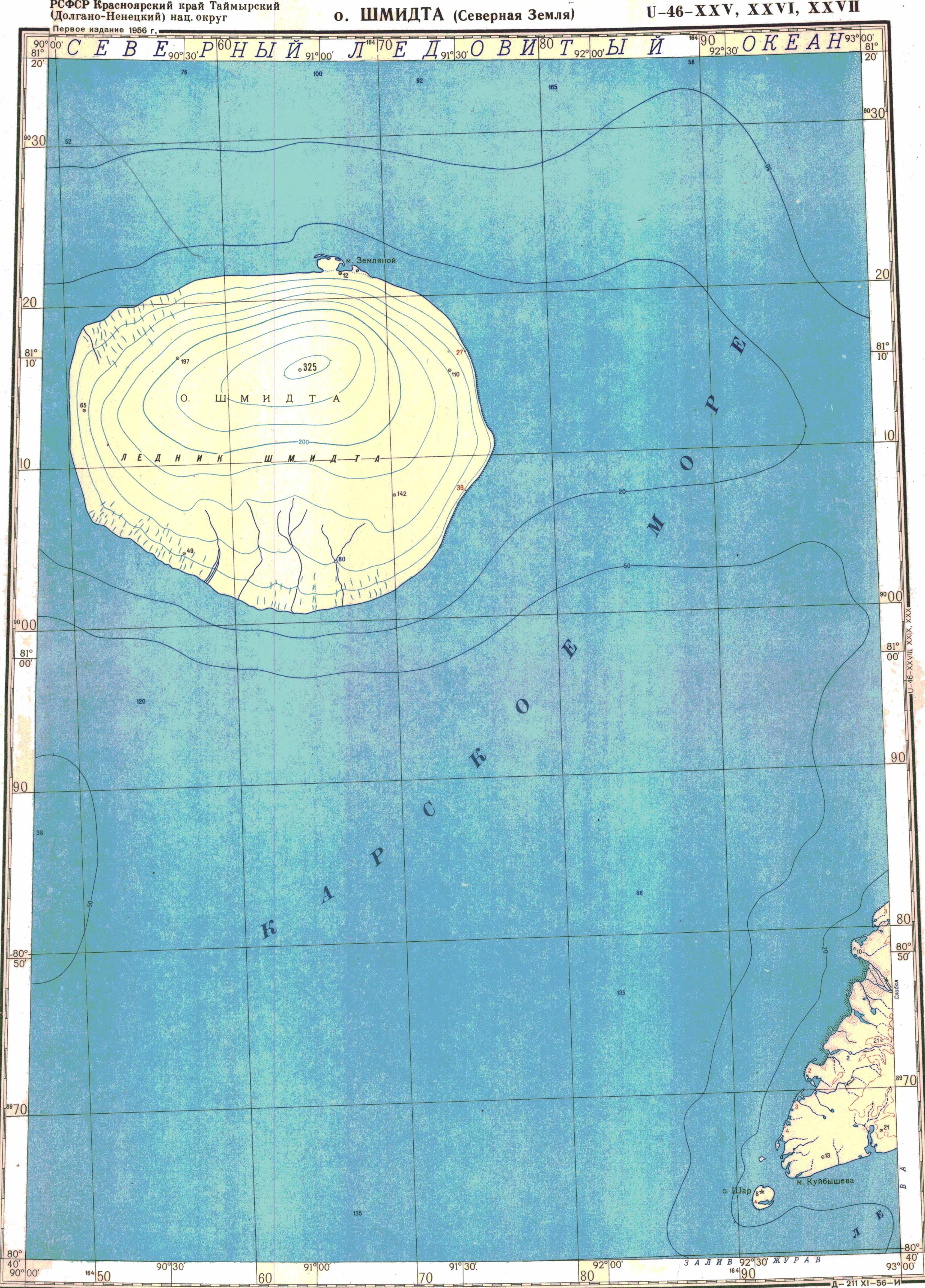
| Geographical location | 81 ° 5 ′ N , 90 ° 25 ′ E | |
|
||
| length | 26 km | |
| width | 18 km | |
| surface | 467 km² | |
| Highest elevation | Schmidt ice cap 325 m |
|
| Residents | uninhabited | |

The Schmidt Island ( Russian Остров Шмидта , Ostrow SmithA ) belongs to the archipelago Severnaya Zemlya in the Russian Arctic .
The approximately 467 km² island is located in the northwest of the archipelago. It is almost completely covered by an ice cap and is named after the Russian scientist Otto Juljewitsch Schmidt , the leader of the expedition that discovered the island in 1930 on board the icebreaker Georgi Sedov .
In 1952, during the Cold War , a Soviet air force base was established here, which would have allowed modified Tupolev Tu-4 bombers to attack US bases in Canada and Greenland with nuclear weapons .

Schmidt Island

Schmidt Island


literature
- Evgeny Pospelow: Geografitscheskie naswanija Rossii . AST, 2008, p. 501. ISBN 978-5-17-054966-5 . (Russian)
Web links
- Article Schmidt-Insel in the Great Soviet Encyclopedia (BSE) , 3rd edition 1969–1978 (Russian)
- topographic map on a scale of 1: 500,000
Islands: Bolshevik | Domaschni | Golomjanny | Komsomolets | Krupskoi | October Revolution | Pioneer | Samoilovich | Schmidt | Starokadomski | Taimyr
Archipelago: Sedov