San Pedro (Chile, volcano)
| San Pedro | ||
|---|---|---|
|
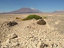
The San Pedro from the south of the San Pedro River seen from |
||
| height | 6145 m | |
| location | Región de Antofagasta , Chile | |
| Mountains | To the | |
| Coordinates | 21 ° 53 ′ 15 ″ S , 68 ° 23 ′ 30 ″ W | |
|
|
||
| Type | Stratovolcano | |
| Last eruption | 1960 | |
The San Pedro is a stratovolcano in the Chilean Atacama Desert . With a height of 6145 m, it is one of the highest active volcanoes on earth.
description
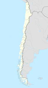
The San Pedro is located in the north of Chile in the Región de Antofagasta . The Río San Pedro de Inacaliri flows about ten kilometers south of the summit . The Cerro del Azufre is located twenty kilometers northeast of the San Pedro .
The San Pedro is a twin volcano with two peaks. In the west lies the San Pedro and in the east the 6092 m high San Pablo . The last eruption of the San Pedro dates back to 1960, the last known eruption to 1938.
See also
Individual evidence
- ^ A b San Pedro in the Global Volcanism Program , accessed May 10, 2015.
- ↑ a b San Pedro. In: volcanodiscovery.com. Retrieved May 10, 2015 .
Web links
Commons : San Pedro Volcano (Antofagasta) - Collection of images, videos and audio files


