Santa Inés (island)
| Santa Inés | ||
|---|---|---|
| Waters | South pacific | |
| Archipelago | fire land | |
| Geographical location | 53 ° 45 ′ S , 72 ° 51 ′ W | |
|
|
||
| length | 92 km | |
| width | 55 km | |
| surface | 3 688 km² | |
| Highest elevation | 1371 m | |
| Residents | uninhabited | |
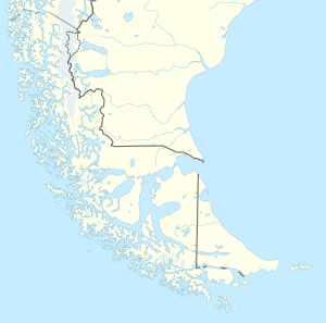
| Map of West Tierra del Fuego with Isla Santa Inés | ||
Santa Inés ( Spanish Isla Santa Inés ) is a large island in southern Chile . Geographically, it belongs to the Tierra del Fuego Archipelago, administratively to the municipality of Punta Arenas in the Región de Magallanes y de la Antártica Chilena . The island, originally inhabited by the Kawesqar tribe, is now uninhabited.
geography
With 3688 km², Santa Inés is the largest island in the west of Tierra del Fuego and the sixth largest island in Chile. It extends along the Strait of Magellan , which is only around 2 kilometers wide ; Opposite it are the island of Riesco and the Brunswick Peninsula , the most south-westerly land mass of the Patagonian mainland. In the southeast the Canal Barbara separates it from the island of Isla Clarence , in the northwest the Canal Abra from the Isla Desolación . Santa Inés is about 90 km long, up to 55 km wide and reaches a height of 1370 m above sea level. Its coast is characterized by numerous bays and fjords ; The German cruiser Dresden hid in one of these fjords in the southern summer of 1914/15 after the sea battle near the Falkland Islands before breaking out into the open Pacific .
Individual evidence
- ↑ a b UNEP Islands (English)
- ↑ USGS Glaciers of the Wet Andes (English)

