Santo Amaro (Recife)
| Bairro de Santo Amaro Santo Amaro |
||
|---|---|---|
|
|
||
| Coordinates | 8 ° 2 '52 " S , 34 ° 52' 45" W | |
 Location of Santo Amaro in Recife Location of Santo Amaro in Recife
|
||
| Basic data | ||
| Country | Brazil | |
| State | Pernambuco | |
| city | Recife | |
| ISO 3166-2 | BR-PE | |
| Administrative region | RPAR 1 | |
| Bairro | Santo Amaro | |
| surface | 3.8 km² | |
| Residents | 27,939 (2010) | |
| density | 7,352.4 Ew. / km² | |
| Time zone | UTC −3 | |
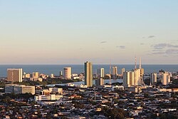
Santo Amaro is a district ( bairro ) of the Recife municipality in Pernambuco , Brazil , was founded in 1814 and incorporated in 1869.
The population according to the IBGE data is 27,939 inhabitants, with a male population of 12,680 (45.38%) inhabitants and a female population of 15,259 (54.62%) inhabitants. The majority of the neighborhood's population is in the 25 to 29 age group, at 13,258.
It is subordinate to the administrative region (Portuguese: região político-administrativa do Recife) RPAR 1, known as Centro do Recife . In the northeast it borders on Olinda .
Web links
Commons : Santo Amaro - collection of images, videos and audio files
Individual evidence
- ↑ a b https://ww2.ibge.gov.br/english/estatistica/populacao/censo2010/primeiros_resultados/populacao_por_municipio_zip.shtm
- ↑ Santo Amaro | Prefeitura do Recife. In: gov.br. www2.recife.pe.gov.br, accessed March 23, 2018 (Brazilian Portuguese).

