Shaft IV
Shaft IV was the name of a mine shaft in the south of Großgoltern and is derived from the name of an adjacent location in the Eckerde district of the city of Barsinghausen in the Hanover region in Lower Saxony .
geography
Shaft IV is located in the agriculturally used flat land between the Deister and the Stemmer Berg about 1 km southwest of Eckerde and 2 km northeast of the Barsinghausen district.
history
In the 1930s, Preussag was already operating three shafts on its Barsinghausen coal mine, which emerged from the monastery tunnel, to mine the Wealden coal that can be found under the Deister and up to the Stemmer Berg . In order to further exploit the trough-like seam between Deister and Stemmer Berg , shaft IV, about 2.5 km from shafts I to III, was sunk in the south of the Großgoltern district southwest of the village of Eckerde. ▼
Shaft IV (Großgoltern)
The 742 m deep shaft IV was completed in just two and a half years. There was a connection underground to shaft I.
During the Second World War , around 164 prisoners of war were deployed in shaft IV, who were quartered in a camp of five barracks on the northern edge of the site. The barracks were then used to accommodate displaced persons until the summer of 1945 .
In 1950 a siding to the Deisterbahn was built , in 1952 a power station. After Preussag had stopped the coal mining of the Barsinghausen colliery in February 1957 for reasons of profitability, the shaft was closed with a concrete plug at a depth of 360 m. and the colliery and power station buildings were demolished in the following years.
Successor use
Teves (ATE) built a plant for the production of piston rings and valves on the premises on Hannoversche Strasse . After the change of ownership to today's Federal-Mogul Valvetrain GmbH, the automotive supplier industry is still based here. A large part of the approximately 100 m high mine dump on the eastern edge of the mine site was used as road construction material. An approximately 20 m high dump stump remained when this use ended in the 1970s due to environmental concerns.
In 2016, Federal Mogul Valvetrain and Bergmann Automotive operations as well as a substation built in 1942 are located on the former site of Shaft IV east of Hannoversche Strasse and on Gießereiweg .
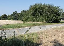
The Hanover Regiobus serves the Gießereiweg stop in the north-west of Shaft IV with around 14 journeys on line 534. Most of the rails of the siding are still available as the Barsinghausen industrial mainline. However, the route is interrupted on the northern edge of Barsinghausen. The unused section of the route through the Feldmark to Shaft IV is now overgrown with trees and bushes.
Shaft IV (Eckerde)
In the area of the Eckerde district, a mixed area with smaller commercial and recycling companies has emerged over the past few decades to the northwest of the K 239 district road to the dump, which is now used as an excavated earth dump. The area is accessed via a spur road, Schacht-IV-Straße . There is no direct road connection between the location of Shaft IV and the former shaft site.
The Hanover Regiobus serves the Eckerde / Uhlenbruch stop southeast of Shaft IV with line 532 and 6 exits of line 534.
environment
To the east of the mine dump, at the edge of shaft IV, the Eckerder ponds are the only protected landscape component of Barsinghausen (as of 2016). The Eckerder ponds were placed under protection on January 26, 1989 as an important refuge for endangered animal species and a habitat for various plant communities .
Others
In January 1974, the industrial area and the surrounding areas were flooded when water pushed out the plug of shaft IV.
Web links
supporting documents
- ^ Georg Römhild: Mining industry on the periphery. The north-west German Wealden coal and the former mining in the Obernkirchen-Barsinghausen mining authority. in settlement research. Archeology - History - Geography. Volume 16 (pdf; 36.4 MB). Verlag Siedlungsforschung Bonn 1998, p. 284 , accessed on August 20, 2016 .
- ↑ Helge Kister: Forced Labor in Barsinghausen. (No longer available online.) Www.ak-regionalgeschichte.de, archived from the original on August 24, 2016 ; accessed on August 20, 2016 .
- ↑ THE DEISTER COAL MINING. (No longer available online.) Www.klosterstollen.de, 2012, archived from the original on August 13, 2016 ; accessed on August 20, 2016 .
- ↑ a b BUS 534. (pdf; 67 kB). RegioBus Hannover, accessed on August 20, 2016 .
- ↑ Industrial mainline city Barsinghausen (former connection shaft IV Eckerde). (No longer available online.) Www.deisterstrecke.de, archived from the original on August 9, 2016 ; accessed on August 20, 2016 .
- ↑ BUS 532. (pdf; 80 kB). RegioBus Hannover, accessed on August 20, 2016 .
- ↑ Eckerder Teiche. in: Geographical Information System of the Hanover Region . Region Hannover, accessed on August 20, 2016 .
- ↑ from the Friends of the Visitors Mine Barsinghausen e. V. on the Hannoversche Strasse at the former shaft IV set up information board
Coordinates: 52 ° 18 ′ 58.3 " N , 9 ° 30 ′ 16.2" E


