Schilt (mountain)
| Scolds | ||
|---|---|---|
|
the Schilt from Glarus |
||
| height | 2298 m above sea level M. | |
| location | Canton of Glarus , Switzerland | |
| Mountains | Glarus Alps | |
| Coordinates | 727 177 / 211 726 | |
|
|
||
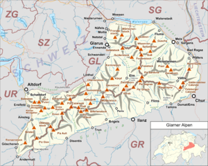
The Schilt is a mountain near Ennenda in Switzerland . It belongs to the Glarus Alps . In Ennenda it is considered the local mountain .
history
On January 8, 1893, the Schilt was first climbed by the Glarnern Christoph Iselin and Jacques Jenny. It is the first Swiss Alpine summit to be climbed on skis.
Location and surroundings
The Schilt is east of Ennenda in the tectonic arena Sardona . He is the namesake of the Schilt mountain group of the same name, to which the Fronalpstock also belongs. To the north of the Schilt are the Fronalpstock and the Schilt ski lift.
Routes to the summit
Route 1
The easiest way to get to the Schilt is via Ennenda and the Äugstenbahn. In Äugsten you go northeast to Alp Begligen, where a path leads directly to the summit.
Route 2
You drive to the Naturfreundehaus Fronalp. A path leads directly to the Schilt.
Ski touring
The Schilt is very popular with ski tourers, who mostly reach the Schilt via Route 2.
Web links
Individual evidence
- ↑ From Schilt to Gufelstock - In search of traces in Glarnerland The Alps 1/2007 on skiliftschilt.ch
- ↑ Overview map on aeugstenbahn.ch

