Schlageterinsel
| Schlageterinsel | ||
|---|---|---|
| Complete view of the Schlageter Island | ||
| Waters | Böhme | |
| Geographical location | 52 ° 59 '52 " N , 9 ° 50' 46" E | |
|
|
||
| length | 15 m | |
| width | 5 m | |
| surface | 0.007 5 ha | |
| Residents | uninhabited | |
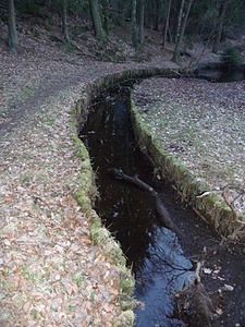
| Graben between Schlageterinsel (right) and the mainland | ||
The Schlageterinsel is a 75 m² artificial island in the Böhme river in the Boehmewald near Soltau in Lower Saxony . The island is separated from the mainland by a ditch about one meter wide, which is built with wooden pillars. The 15 m long and 5 to 6 m wide island is connected to the mainland by a small wooden bridge.
In 1897 the honorary citizen of Soltau, Wilhelm Röders sen., Bought the Boehmewald as a " recreational forest ". an area opposite the Böhmebogen, had the Böhme put in a slight loop and the area of the old river course lying in the curve to the island.
The island, named 30 years later after the German free corps fighter Albert Leo Schlageter , is mainly overgrown with nettles and other herbaceous plants. In the middle there is also a steadfast chestnut and an elm . Schlageter is named after a controversial figure, as he served the National Socialists as a martyr figure .
Web links
Individual evidence
- ↑ Willy Klapproth: 1945 war chronicle of the city of Soltau and the surrounding area with contributions to the war history of 1945 in the southern and central heath , published by the city administration, 1955


