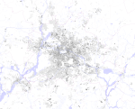
Figure Ground Plan
The black plan is an instrument of urban planning for displaying buildings in a selected map section. All other plan elements such as streets, vegetation or bodies of water are hidden. This modification allows a clear distinction between built-up areas (shown in black) and undeveloped areas (shown in white). With the help of this plan, the urban morphology and its development can be examined. The plan La Nuova Topografia di Roma (the new topography of Rome) by Giovanni Battista Nolli from 1748 is considered to be one of the first representations of this type or as a forerunner .
target
The figure ground plan is used as a tool for urban planning and, in some cases, landscape planning to analyze urban structures . It vividly depicts the density and grain of the space-defining building masses of a city. The building structure in the form of open and closed buildings can be read from the Figure Ground Plan. The city modules - such as block, row, row and solitaire - can be spatially assigned using the plan. The different building types are clearly visible in the figure ground plan. It represents, for example, detached one and two-family houses , row houses , apartment buildings and special structures. The layout and location of the buildings and the surrounding open space can be found in the Figure Ground Plan. The plan provides information about the respective building structure and shows the existing building typologies. It also visualizes room edges and room effects. Since nothing is added to the plan and it has been greatly reduced in terms of form , it is a striking infographic .
Figure Ground Plan Green
The Figure Ground Plan Green represents the floor plans and basic forms of the urban landscape architecture. In this plan, open space types such as gardens, front gardens, green areas, tree slices, traffic islands, embankments and spacing green are visualized as black areas, provided they are part or boundary element of the public space of the streets, Have places and waters defined. The Figure Ground Plan Green shows the net texture of the urban green and open space as an object texture.
literature
- Inga Mueller-Haagen, Jörn Simonsen, Lothar Többen: The DNA of the city. An atlas of urban structures in Germany . Mainz: Hermann Schmidt, 2014
Web links
- Figure ground plan of Munich with explanation
- Figure ground plans of Berlin from different periods of time
Individual evidence
- ↑ a b Inga Mueller-Haagen, Jörn Simonsen, Lothar Többen: The DNA of the City: An Atlas of Urban Structures in Germany. Hermann Schmidt, Mainz 2014, ISBN 978-3-87439-852-7 , pp. 12-13 .
- ↑ Lecture and exercise. Technische Universität Darmstadt, Department of Design and Urban Development, accessed on July 28, 2019 .
- ↑ Figure Ground Plan Green. Technical University of Munich, Department of Landscape Architecture of Regional Open Spaces, accessed on July 28, 2019 .

