Sellenbüren
| Sellenbüren | ||
|---|---|---|
| State : |
|
|
| Canton : |
|
|
| District : | Affoltern | |
| Political community : | Stallikon | |
| Postal code : | no own | |
| Coordinates : | 678 904 / 244133 | |
| Height : | 550 m above sea level M. | |
|
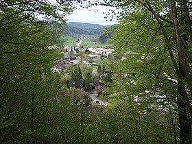
Sellenbüren, in the background Stallikon |
||
| map | ||
|
|
||
Sellenbüren is a district in the political municipality of Stallikon in the Affoltern district in the Swiss canton of Zurich .
coat of arms
- Black bear head with red tongues in gold
The map by Jos Murer from 1566 shows Sellenbüren with the family coat of arms of the barons of Sellenbüren .
geography
Sellenbüren lies in the lower Reppisch Valley, between the Reppisch and the western slope of the Uetliberg . Sellenbüren Castle once stood above the village, on the so-called “ Ofengüpf ” . With a significantly higher number of settlements, Sellenbüren is much larger than the village of Stallikon.


