Transmitter bridge
Coordinates: 47 ° 26 ′ 52 ″ N , 9 ° 42 ′ 1 ″ E
| Transmitter bridge | ||
|---|---|---|
| Transmitter bridge - looking towards Dornbirn. In the background the Bödele / Hochälpele - Dornbirner First - Hohe Staufen and Breitenberg (from left to right) | ||
| use | Transport, pedestrians | |
| Convicted | Dornbirn Oh | |
| place | Dornbirn / Lauterach | |
| construction | Wood | |
| overall length | 75 m | |
| width | 6.5 m | |
| Clear height | 2.4 meters | |
| start of building | 1915 | |
| completion | 1916 | |
| location | ||
|
|
||
| Above sea level | 404 m above sea level A. | |
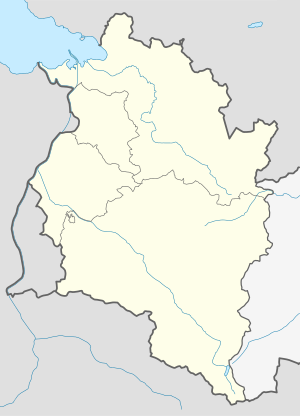
The transmitter bridge ( 404 m above sea level ) is located in the municipality of Dornbirn or the market town of Lauterach in Vorarlberg , Austria . The covered bridge is on the Dornbirn page listed building ( list entry ).
Motor vehicle traffic, pedestrian and bicycle traffic cross the bridge on the same lane. The bridge, built in 1915/1916, was built primarily for transport purposes and leads over the Dornbirn Ach .
Surname
The name of the sender bridge is derived from about 120 meters to the northeast lies ORF - lauterach transmitter off, which was built 1933rd
history
In 1875, a covered wooden bridge was built a little south of today's steel bridge ( Wiesenrainbrücke ) at the expense of the community of Widnau , in order to be able to manage the agricultural land of the Widnau farmers (so-called "Schweizer Rieder" in the southern part of Lustenau) in Austria more easily. This “private bridge” of the Swiss farmers was not approved for public border traffic. The Austrian tax authorities did not want an additional customs office on Wiesenrain. The other two Rhine bridges in the municipal area of Lustenau, the upper drive bridge and the lower drive bridge, should not have any additional competition. This covered wooden bridge was demolished in 1912 as part of the work to regulate the Rhine .
The previous covered wooden bridge (later referred to as the Old Widnauer Bridge ) was split into four parts and one part became the Nöllenbrücke in Widnau, which still exists today . The market town of Lustenau and the Hofsteig communities acquired the central part of the bridge in 1914 and adapted it for the current transmitter bridge. Two other parts of this Rhine bridge were used as local bridges and led to the Widnau part of the Swiss Ried in Lustenau (these two bridges burned down).
Before the transmitter bridge was built, there had been a simple wooden walkway here since 1873.
location
The wooden bridge lies in the middle of the European protected area Soren, Gleggen-Köblern, Schweizer Ried and Birken-Schwarzes Zeug . The state road L41 (also: Senderstraße ) runs over the bridge . This connects the municipality of Lauterach (in the northeast) with the municipality of Dornbirn (in the southwest). About 90 meters southwest of the transmitter bridge, the Höchsterstraße ( Werbenstraße L 42) coming from Dornbirn joins the Senderstraße. The L41 continues to Lustenau ( called Zellgasse here ).
The Dornbirner Ache is bridged by the bridge at 6.44 kilometers.
The municipal boundary of Lustenau is about 140 meters away. The Rhine Valley Inner Canal flows into the Dornbirner Ache about 500 meters northwest of the transmitter bridge .
Building
The bridge with Howeschen girders has a length of about 75 meters. In some cases, multi-lane vehicles can only pass through it in one lane (oncoming traffic must wait). There is a weight limit of 3.5 tons and a height limit of 2.4 meters. The maximum throughput speed is 10 km / h.
Damage to the transmitter bridge occurs almost every week due to careless vehicle drivers. The bridge was originally designed for horse-drawn vehicles, while today 6,000 to 7,000 vehicles drive over the old structure every day. When the maximum speed of 10 km / h is exceeded, struts are also released by the vibrations triggered. Around 10,000 euros are spent annually on repair work. In 2016 the road was completely renewed for around 500,000 euros.
Trivia
Every month or so, drivers of heavy trucks disregard the height and weight restrictions that are placed far in front of the bridge, mostly because they rely on a navigation device and have to be recovered. Trucks have to be guided back on the narrow road about weekly.
Web links
Individual evidence
- ↑ DEHIO Vorarlberg 1983: SENDERBRÜCKE.
- ↑ 12 - Alte Widnauer Brücke , website of the market town of Lustenau.
- ^ Markus Kaiser: Widnau. In: Historical Lexicon of Switzerland . November 11, 2014 , accessed July 10, 2019 .
- ↑ The history of the bridge , website: Tagblatt: ch of June 29, 2012.
- ↑ According to the information board of the community of Widnau near the Nöllenbrücke.
- ↑ Susi Miara: New bridge based on the old model , Tagblatt.ch of June 29, 2012.
- ↑ a b c Wanted: New place for old bridge , neue.at from September 3, 2017.
- ↑ Photo: Widnauer Brücke - copy , website: vorarlbergmuseen.at.


