Staufen (Bregenz Forest Mountains)
| Staufen | ||
|---|---|---|
|
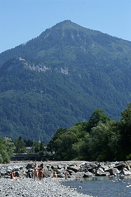
The Staufen seen from Dornbirn |
||
| height | 1465 m above sea level A. | |
| location | Vorarlberg , Austria | |
| Mountains | Schuttannenberge , Bregenz Forest Mountains | |
| Dominance | 1.8 km → Schwarzenberg | |
| Notch height | 320 m ↓ rubble firs | |
| Coordinates | 47 ° 22 '34 " N , 9 ° 45' 19" E | |
|
|
||
| Normal way | Hiking trail from the Schuttannen-Alpe or the mountain station of the Karrenseilbahn cable car | |
The Staufen (in the local dialect [ 'ʃtoufə ]) is a 1,465 meter high mountain in the far west of the Bregenzerwald Mountains , which rises from the foot of the Vorarlberg Rhine Valley . Often the peak is due to their distinctive stand-alone form as mountain Dornbirn referred, although the peak of the mountain on the municipal border between the cities of Dornbirn and Hohenems is. The Staufen is connected to the actual Dornbirn local mountain, the 971 meter high Karren , via a mountain ridge.
Web links
Commons : Staufen - collection of images, videos and audio files


